VICTORIA -- As the weekend approaches, so too does a whole lot of rain.
May be a good weekend to start a fire, cozy up under a blanket and watch a few classic movies. May I suggest A River Runs Through It. That’s exactly what’s happening weather-wise, although in our case it’s an atmospheric river.
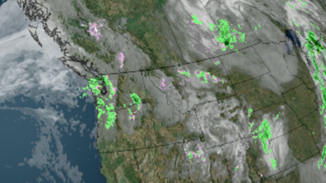
With two frontal systems rolling in back-to-back, this river in the sky will drop some significant amounts of moisture.
With the approaching fronts, Environment and Climate Change Canada has issued a special weather statement for Friday morning to Sunday morning.
Not only will we contend with high water content but strong wind gusts will accompany these fronts also.
Southeasterly winds will pick up on Friday and will stay strong with the passage of the two fronts.
We’re also watching some warming air that could create some snow melt and runoff in the higher elevations. Main concerns will be the swelling of local streams, localized flooding and falling trees and branches.
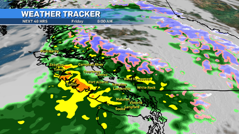
The areas under the special weather statement are the western and mountainous sections of Vancouver Island, Sunshine Coast near Sechelt and Gibsons, Howe Sound, Whistler, Metro Vancouver and the Fraser Valley – especially in communities near the mountains, such as Mission.
Eastern sections of Vancouver Island, near Bowser, may also be affected. At this point, numbers are ranging from 75 to 150 milimetres of rain over the duration of these systems.
It’s expected the west coast and inland areas of Vancouver Island will see the most rain, especially on the west side of the mountains.
Some heavy downpours could travel farther east and deliver some bigger rainfall numbers to areas like Comox and Campbell River, as well as Cumberland.
Some spots over the next few days could more than double the rainfall totals they’ve seen so far in October. To report severe weather, send an email to BCstorm@canada.ca or tweet reports using the hashtag #BCStorm.


