From Greater Victoria to Nanaimo reports of early morning flurries got the conversation going on Twitter!
#Nanaimo this morning | ��@CTVNewsAstrid @CTVNewsVI pic.twitter.com/PWq1AqmctI
— Jessica Lepp (@CTVNewsJess) January 10, 2017
Classic sea effect upslope #snow falling at #WWS #Nanaimo #bcstorm 3-4 cm so far. @CTVNewsAstrid @MMadryga @michaelkusswx @ECCCWeatherBC pic.twitter.com/k7ueTxLqlz
— Josh Wynia (@wyniasweather) January 10, 2017
Outflow winds crossing the Strait of Georgia were responsible for the morning snowfall in Nanaimo.
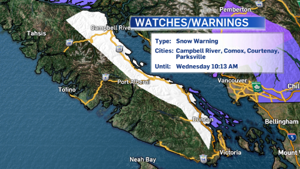
As conditions are expected to continue throughout the afternoon, a snowfall warning is in effect for East Vancouver Island. Nanaimo and the surrounding can expect variable amounts of snow today, with some neighbourhoods getting up to 10 centimetres.
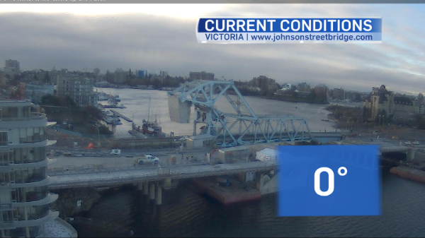
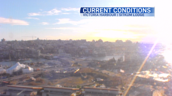
To the south, conditions began to clear early this morning. Here’s the view at 9:45am over Victoria:
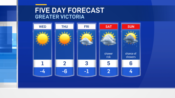
For many island communities, today is a transition day for weather. The low that is responsible for a weekend of wintry precipitation is on the way south, and it’s weakening.
Winds are flowing out to the coast from the northeast as another round of Arctic air settles in over southern B.C. The ridge of high pressure will help to keep our skies nice and clear, but temperatures will be cold again for several days, with daytime highs struggling to break the freezing mark in many island communities.
Winds will continue to be gusty so the wind chill will be a factor, making the air feel colder than it actually is.
By Friday night, we’ll get some precipitation again. It’ll be snow while temperatures are cold, but it will change to rain as milder temperatures move in for the weekend.
By next week we’ll actually experience conditions that are considered to be “normal”, with highs around 7°C or slightly milder.