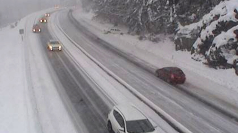
Snow is falling once again on Vancouver Island, but the new round of precipitation could be slushier than previous snowfalls.
Snowfall warnings have been issued for B.C.'s South Coast including Greater Victoria, the Southern Gulf Islands and east Vancouver Island from Courtenay to Campbell River, Duncan to Nanaimo and Nanoose Bay to Fanny Bay.
Environment Canada says an additional five to 10 centimetres of snow is expected to fall by Friday morning, but it could change to rain for some areas.
"Some areas will see that mix of rain and snow continuing throughout the day [Friday]," said Meteorologist Carmen Hartt. "We're expecting it to be heavier snow because there is a little bit more warmth with this system."
The snow comes as a result of another area of low pressure approaching B.C.'s South Coast combined with Arctic air still hovering over the region.
The Malahat Highway summit had already been blanketed by snow as of 4:30 p.m. Thursday.
Environment Canada is warning drivers to prepare for quickly changing and deteriorating weather conditions.
As for when this unusual blast of wintry weather will end, Hartt said islanders shouldn't hold their breath.
"At this point we're just going to have to keep waiting until March and into the spring for the warmer weather," she said.
