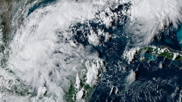
It has been a remarkably quiet Atlantic hurricane season as a strengthening El Nino in the Pacific is creating a disruptive wind environment for potential storms. That said, a new tropical storm has developed in the Gulf of Mexico. Isaias is not expected to impact the Maritimes during its tropical phase, but the remnants will need to be watched Monday into Tuesday of next week. As of noon Wednesday, Isaias was a tropical storm with maximum sustained winds near 75 km/h. The centre of the storm is located about 870 km due south of the mouth of the Mississippi River. The storm is forecast to strengthen first to a category-one then category-two hurricane by Friday morning as it moves northeast over the Gulf of Mexico. It’s expected to make landfall on either the Florida Panhandle, Alabama or Mississippi late on Friday. The storm would then weaken as it progresses northward towards Kentucky and Indiana by Sunday morning. The influx of warm, moist air from the Gulf of Mexico into continental North America may result in temperatures rising well above seasonable for areas of Canada, Southern Ontario east to the Maritimes this Thanksgiving long weekend. What to watch for in the Maritimes While the system is expected to transition to post-tropical remnants by Sunday, those remnants could still pack quite a bit of moisture. There remains the possibility that the remnants meet up with a separate weather front approaching from the west during the Monday-Tuesday period of next week in the vicinity of the Maritimes. Should those two systems meet up in our area, it would be recipe for rain, potentially heavy if a good deal of moisture is left with the system. There is a tremendous amount of uncertainty about when and if it could have an impact on our region. It will all depend on how the storm behaves in the Gulf of Mexico, where it makes landfall and how much moisture will be taken out of during its progress over the continent. There is no reason for worry at this time. Just be aware that Monday into Tuesday of next week is a period to watch in the forecast. Temperature ups and downs In the meantime, we have fluctuating October temperatures to talk about heading into and through the long weekend. A return to a blustery southwest wind will boost up temperatures on Thursday. Here is what to expect: High temperatures in the mid-to-high teens Friday will dip cooler for the start of Thanksgiving weekend. There will be a brisk feel to the air on Saturday with daytime highs mostly 9 to 13 C. Temperatures Sunday into Monday will heavily depend on the progress of tropical storm Isaias. I am expecting that we will be feeling some of the warmer air from that system by that time.