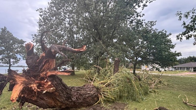
Tuesday and early Wednesday’s widespread severe weather outbreak in Winnipeg and across southern Manitoba won’t soon be forgotten. Reports of tornadoes, unrelenting severe thunderstorms, hail the size of tennis balls, torrential rain and exceptionally strong wind gusts caused an untold amount of damage. Environment and Climate Change Canada (ECCC) said reports of tornadoes were received in Ste. Anne and Otterburne, adding numerous funnel cloud and possible tornado reports also came in from much of the Red River Valley and the Parkland region. With many folks contending with power outages, flooded basements and yards, and other damage, the last thing needed is more severe thunderstorms in southeastern Manitoba on Wednesday, but they are very possible. The weather agency has issued a severe thunderstorm watch (yellow) Wednesday for Winnipeg and the rest of the southeast. An approaching cold front will encounter an unstable airmass in the afternoon that could trigger thunderstorms that could become severe. According to ECCC, thunderstorms are expected to develop early in the afternoon and then diminish early evening. Large hail, strong and gusty winds, heavy rain, and flash flooding in flood-prone areas are all potential threats. Meanwhile, the weather agency issued a special weather statement Wednesday for the southwest corner of the province, including Melita, Pipestone, Boissevain and Virden. ECCC warns a low pressure system in southern Saskatchewan could produce weak thunderstorms, some of which could spawn funnel clouds today. Keep your eyes on the skies. Even more rain or thunderstorms are likely in both southern and northern Manitoba on Thursday.