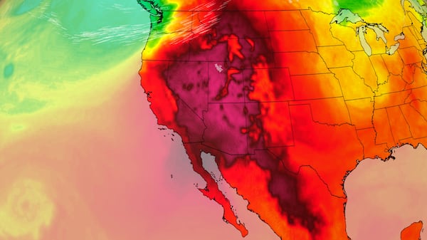
A dominant ridge of high pressure will continue to serve as the main weather-maker for southern Alberta and Saskatchewan today and early tomorrow. Both daytime highs and overnight lows will remain elevated with portions of southern Alberta expected to reach 30 C or warmer. In Calgary, the forecast high for Monday is 26 C, compared to the average high of 18 C. It will be mainly sunny with a mild wind in the afternoon, and an overnight low of 14 C. The start of Tuesday will be very similar to Monday with sunshine and warmer temperatures; however, conditions will start to deteriorate in an unusual weather pattern throughout the afternoon. A shortwave trough is expected to develop on the eastern side of that ridge and create some instability on both sides of the Rockies on Tuesday afternoon as that low-pressure system tracks south to north from Montana toward the Trans-Canada Highway. Showers and thunderstorms are likely, especially south of Calgary initially. This pattern will continue Wednesday and Thursday and there is potential for some of those storm cells to rapidly intensify as cooler air slams into that warm and stable air mass and wind shear fuels development. If those storms do develop, the greatest threats would likely include periods of intense rain, damaging wind and hail. Daytime highs will remain warmer than average for most of this week and overnight lows are expected to sit in the double-digits compared to the average low in Calgary of 5 C.