
Heavy rains and high winds whipped across Vancouver Island again today.
Big gusts on Galiano right now. ������☔️�� #bcstormwatching #bcstorm #southerngulfislands pic.twitter.com/8zl1ycZY3b
— Tour Galiano Island (@TourGaliano) October 18, 2017
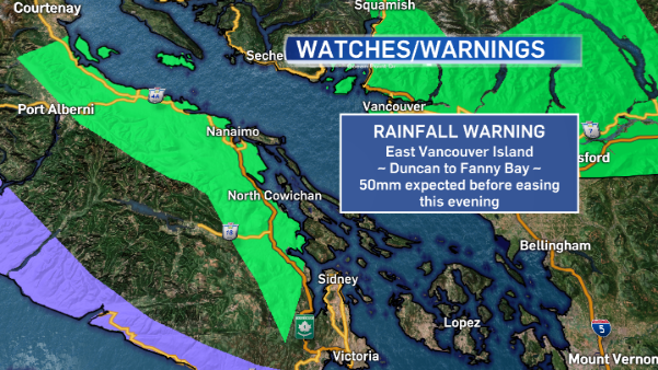
Wind warnings were lifted on Vancouver Island this afternoon, just in time for a rainfall warning to be issued for East Vancouver Island.
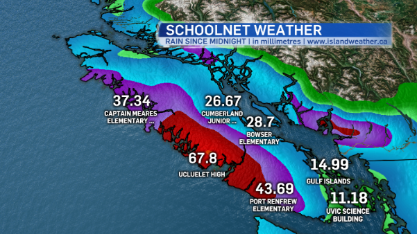
Since midnight, the School-Based Weather Sensor Network has recorded a tremendous amount of precipitation at schools throughout island neighbourhoods.
And there’s more to come! Rain will continue all over Vancouver Island this afternoon until it eases to showers tonight. At the higher elevations where it’s a little cooler (like Mount Washington) precipitation has fallen as snow or a rain-snow mix.
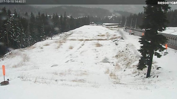
Mount Washington Tube Cam (www.mountwashington.ca)
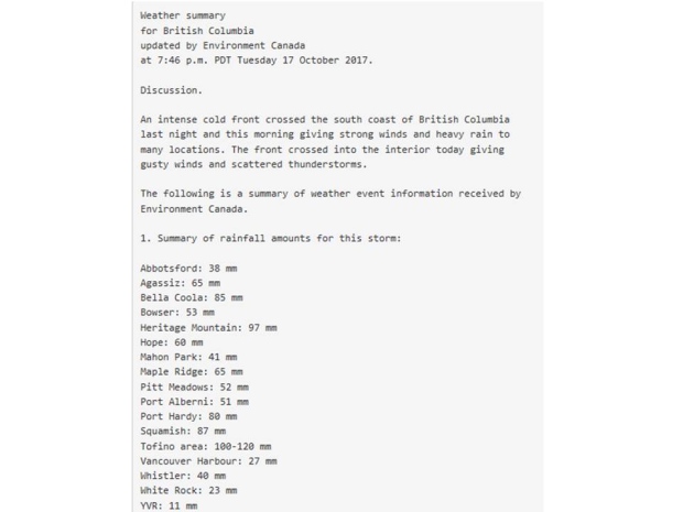
Today’s stormy weather follows a round of rainy, windy weather which packed a punch Monday night through Tuesday. The west coast got the worst of it. Since the storm cycle began the Effingham Weather station recorded half a meter of rain!
Drum roll: Effingham weather station, inland from #Tofino, has recorded 500mm, yes half a meter, of rain since Sunday #BuildTheArk #BCstorm pic.twitter.com/cXdJQLH8Av
— ECCC Weather BC (@ECCCWeatherBC) October 18, 2017
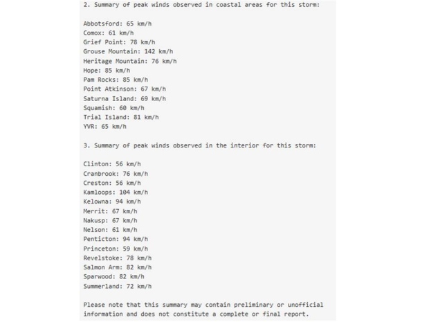
Here’s a look at the other rainfall and wind speed statistics from Tuesday, as recorded and reported by Environment Canada.
Rainy, windy weather eases Thursday although we’re not completely in the clear. Showers are expected along with a chance of isolated thunderstorms thanks to lingering instability behind the front. Friday looks a little brighter, but another system approaches Saturday bringing rainy, windy weather to our island in the Pacific again.


