
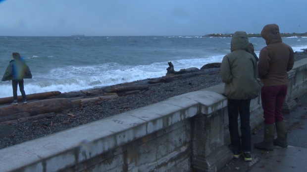
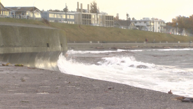
Well, winds were certainly strong, but the dire forecast didn’t really pan out. Meteorologists all over the Pacific Northwest are scratching their heads trying to figure out how a forecast for a major windstorm set to blanket the South Coast of B.C. could end up being so underwhelming in so many areas.
Did the storm track just a little too far west? Was the centre of the low actually two lows that the computer models didn’t pick up until it was upon us? This is a lesson to all of us in the world of atmospheric sciences.
Scott Sistek at KOMO 4 News in Seattle posted his perspective, a look back at the computer forecast models, and what lead us all to present the warnings we did last week.
http://komonews.com/weather/scotts-weather-blog/what-the-heck-went-wrong-with-the-storm-forecast
Looking back at the wind speeds, recorded and reported by Environment Canada, there were pockets throughout the South Coast of B.C. where the predictions for 100km/h winds late Saturday held true:
- Race Rocks 100km/h
- Trial Island 96 km/h
- Howe Sound - Pam Rocks 111km/h
- Sisters Island 109 km/h
- Ballenas Island 107 km/h
But, the gusts weren’t nearly as impressive at YVR where winds measured 63 km/h. Abbotsford Airport in the Fraser Valley had winds at just 59km/h. A complete summary of maximum wind gusts Saturday is below.
Rainfall was heavy at times too, as expected. At Comox Airport, for example, Saturday brought 45.6mm! That’s a lot. Squamish measured 32.8mm of rain and Powell River got 24.5mm of rain. (BTW, I’m still tallying the three-storm cumulative rainfall totals, but they appear to be on track for the 80-200mm rain called for in the forecast.)
Environment Canada provided a summary of Saturday’s storm information this morning noting the predicted track of the storm was pretty much what we expected.
“An intense but compact storm moved across the South Coast last night. The low pressure centre associated with the storm made landfall along Vancouver Island near Bamfield at around 7pm, then tracked northeastward, moving just south of Port Alberni before crossing onto the Sunshine Coast. As the storm approached the coast, very strong southeast winds developed up the Strait of Georgia impacting many of the islands and the Sunshine Coast. As the storm moved across the Island, a plume of very strong southerly winds developed just south of the low extending from near Carmanah into Howe Sound. The very compact structure of the low produced intense winds but over a fairly limited area. The track onto the Sunshine Coast limited impacts to regions further south.“
The important part of that summary is that the storm produced the strong winds and heavy rains in a compact and limited area, not a widespread area.
For many days leading up to Saturday forecasters watched computer models take the many ingredients and try to make sense of them; remnants of a typhoon (a storm with tropical moisture and characteristics) coupled with a strong jet stream should have done what it’s done before in the Pacific Northwest and send a widespread damaging windstorm our way. But it didn’t.
The National Weather Service in Portland, Oregon had this to say about the storm on Facebook
https://www.facebook.com/NWSPortland/posts/1176327089080120
The moral of the story is that, while we’ve come a long way in being able to predict storms and weather scenarios using complex mathematics, physics and technology, and on the whole, we can accurately predict the weather, there’s still a lot to learn. The atmosphere is a ridiculously complex thing with so many variables. It’s not an exact or perfect science. I don’t know if it will ever be, considering how easily and quickly things can change.
In the end a windstorm did hit the coast, and we were prepared. That’s a good thing. Was it a bit disappointing for storm watchers and forecasters? Yes.
Summary of maximum wind speeds Saturday October 15, 2016.
Environment Canada
Greater Victoria
- Trial Island: 96
- Discovery Island: 85
- Haro Strait - Kelp Reefs: 85
- YYJ: 69
- Gonzales Point: 61
- Race Rocks: 100
Metro Vancouver
- Point Atkinson (Lighthouse Park): 91
- Tssawwassen Ferry Terminal: 72
- Sandheads Lightstation: 80
- YVR: 63
Fraser Valley
- Abbotsford Airport: 59
Howe Sound
- Pam Rocks: 111
East Vancouver Island & Gulf Islands
- Entrance Island: 85
- Sisters Island: 109
- Ballenas Island: 107
- Saturna Island: 98
- Chrome Island: 94
- Nanaimo Airport: 70
Sunshine Coast
- Sechelt: 74
- Grief Point (near Powell River): 89
- Merry Island: 96
West Vancouver Island
- Carmanah Lighthouse: 83
- Cape Beale Lighthouse: 78


