
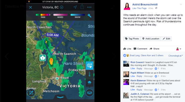
Who needs an alarm clock when you can wake up to claps of thunder!
Many people on southern Vancouver Island heard the rumblings of thunderstorms in the wee hours of the morning today.
If you’re on Facebook, join the weather conversation! www.facebook.com/AstridBraunschmidt
Along with the thunder, flashes of lightning and brief showers all contributed to this morning’s weather drama.
Thunderstorms are expected over Vancouver Island throughout the morning thanks to an upper trough producing unstable conditions. Later today the risk of thunderstorms moves to the interior of B.C.
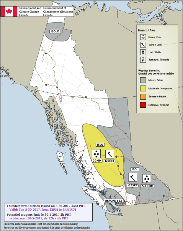
Today’s convective outlook, as forecast by Environment and Climate Change Canada.
Low stratus cloud and fog continues to sock in the west coast of the island and communities to the north this morning although it will dissipate. Showers are expected to continue at times today with few sunny breaks. By now, you’ve probably noticed how much cooler the temperatures are, too! Today will be 10°C cooler than yesterday in some cases. Expect daytime highs to be between 13°C and 17°C on the island – a far cry from Monday’s high 20’s!
Wednesday brightens a little as we get a break between systems. Another couple of fronts bring precipitation to the island late Wednesday through Friday before clearing up – and warming up – just in time for the weekend.


