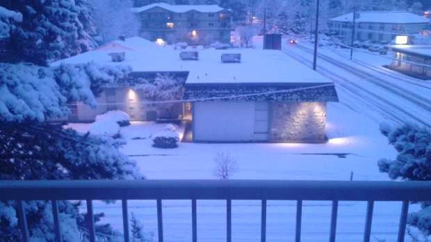
Many island communities started the day with snow as cold conditions provided a taste of winter.
Barbara Walton took this picture in Lake Cowichan this morning, one of the areas that saw some of the greatest amounts of snow on the island.
In Pictures: Islanders wake up to dose of winter weather
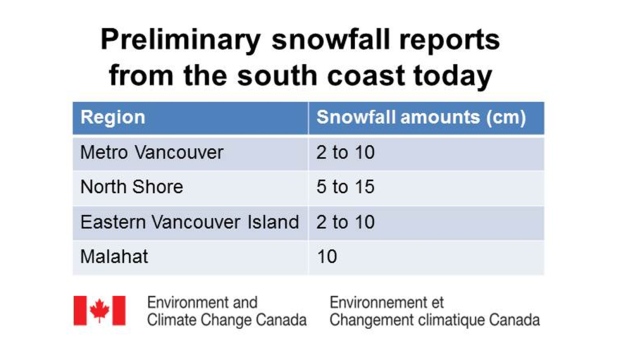
Webcams across the island showed a dusting to a few centimeters of snow across the island from the Malahat to Port Alice before sunrise.
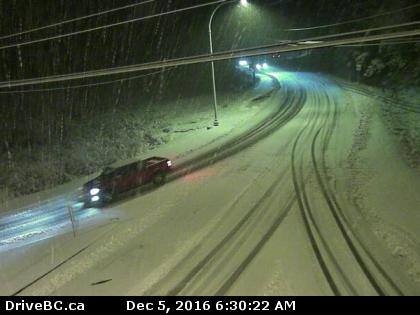
Accumulation varied with elevation, proximity to the water and surface temperature. Downtown Victoria didn’t get any of the white stuff. In Saanich wet snow fell around 6:00am, although it didn't stick.
A snowfall warning was issued around 4:30am for Greater Victoria and East Vancouver Island, warning of up to 5cm of snow, especially through inland areas and at higher elevations. The warnings were lifted before 10:00am.
Next up in the wintry weather forecast is an arctic outbreak, the first of the season. Cold air will begin to funnel out of coastal inlets this evening delivering some of the coldest temperatures we've had since last winter. Strong outflow winds are expected through coastal inlets tonight. The windchill will be a factor. Tuesday night will be the coldest night this week with overnight lows between -4°C and -7°C.
The cold, dry air mass remains in place through Wednesday. Skies will be clear. From Wednesday night through early Thursday morning Vancouver Island can expect another round of snow as a Pacific system brings moist air from the southwest to collide with cold conditions; a recipe for snow.
Temperatures warm a little, but not too much, allowing for showers or flurries, or a rain-snow mix, to be the dominant weather feature through the weekend.