
It’s the first day of meteorological winter and it definitely feels like it! After another bout of rain, cold air is going to funnel out to the coast. Combine some moist air and there’s a chance we’ll get some snow on Vancouver Island, in areas other than Mount Washington, next week.
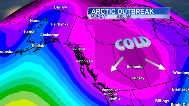
An arctic outbreak pushes cold air from northern B.C. out to Vancouver Island starting Sunday night.
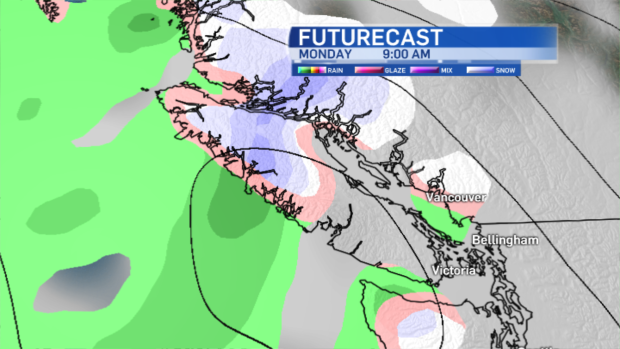
Monday temperatures will be cold enough to allow for snow, if the low crossing northern Washington state pushes moist air towards the island at just the right time. The probability of a rain/snow mix in Victoria is about 40% Monday, but it’s higher towards the north end of the island.
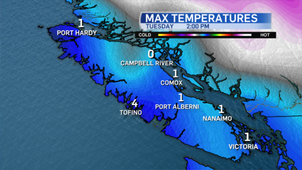
Cold air remains in place Tuesday and Wednesday. Daytime highs will be hovering around the freezing mark.
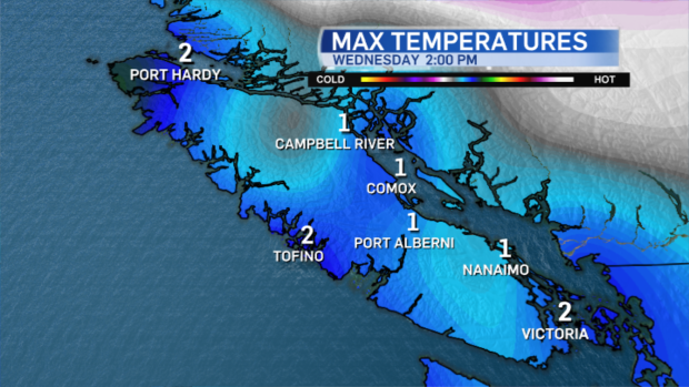
Another round of snow looks like it’ll develop Wednesday. It’ll certainly be cold enough for flurries.
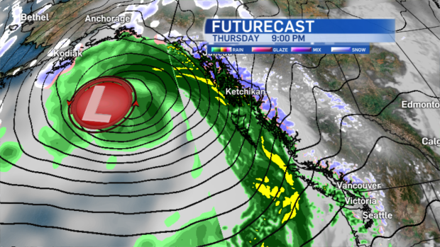
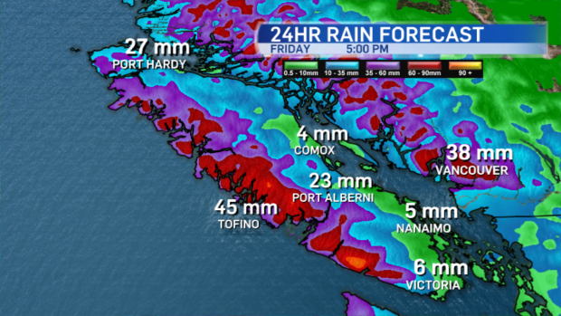
The cold air follows tonight’s system which brings mild conditions to the island, plenty of rain and gusty winds.
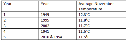
And this system is on the heels of an unusually mild November. Unlike Vancouver and Kelowna it wasn’t the warmest on record, but November 2016 is in the top 5 warmest November’s in Victoria since 1940:
If you don’t like the cold, enjoy the mild conditions tomorrow, even though it’ll be grey and wet, but keep your fingers crossed for some snow for the kids who are begging me for it (cause they want to build a snowman!). I for one am looking forward to a bit more sunshine, even though it’ll be cold.


