
This weekend the weather will be quite different north to south on the island.
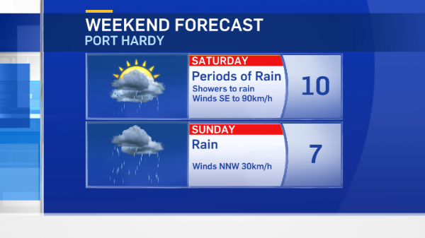
In short, if you’re around Port Hardy, expect a fair amount of rain and potentially damaging winds. If you’re in the Greater Victoria area, you’re in for more sunshine.
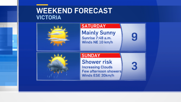
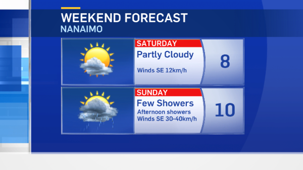
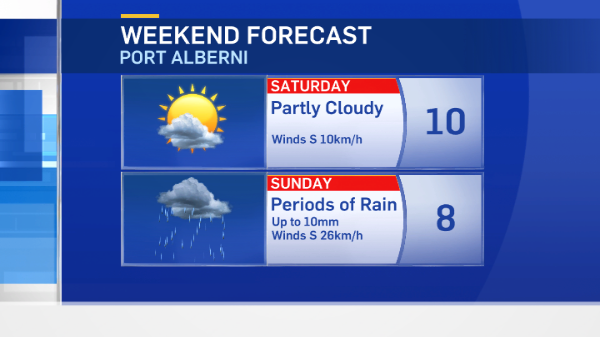
Your weekend forecasts:
Stormy conditions
A wind warning has been issued for North Vancouver Island. Late last night an intense frontal system brought strong southeasterly winds to Haida Gwaii and exposed coastal sections of the North Coast.
Wind speeds at Massett Municipal Airport reached SSE 59km/h gusting to 89km/h around 10 o’clock last night.
Another frontal system is approaching, affecting Haida Gwaii, the north and central coast and north Vancouver Island.
Winds from the southeast are expected to top 90km/h again overnight before weakening Saturday morning. This system brings a fair amount of rain to the north island in the next 48 hours. It takes a while to move south, stalling over the north and mid-island before making its way to Victoria on Sunday afternoon where it appears to lose steam. Expect a few showers in the Capital Region Sunday afternoon.
The arrival of the front and the increase in winds signals an end to the air quality advisory that had been issued for the Comox Valley area.
Next week
High pressure dominates our weather pattern again and colder air takes hold.
Daytime highs will be slightly below average (after a milder-than-average weekend) and overnight lows will be below freezing mid-week.
If you love snow, you might get another taste of it. There’s a chance it’ll be cold enough on Wednesday for some parts of the island to see a few flurries. They’ll be short-lived, if they develop at all.
Milder temperatures follow quickly for the first weekend of February.


