
We had lots of different winter precipitation in the last 24 hours: snow, freezing rain, rain and graupel blanketed parts of Vancouver Island between Sunday afternoon and Monday morning.
Elevation, temperature and proximity to the water were main factors in the type of precipitation that fell.
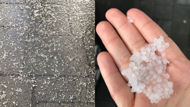
In my Saanich neighbourhood, this morning’s showers turned to heavy rain then to graupel in a matter of minutes.
It was almost exactly one month ago that we had graupel in the Capital Region. December 5, 2016 I offered a brief explanation of how it forms:
The front that moved through Sunday afternoon and evening dropped measureable amounts of snow to many island communities.
Here is a summary of island snowfall up to 7a.m. today, as reported by Environment Canada.
- Campbell River Airport: 8 cm
- Qualicum Bay: 8 cm
- North Courtenay: 8 cm
- Malahat: 8 cm
- Mount Washington Alpine Resort: 18 cm
Freezing rain was reported in parts of the Alberni Valley over the weekend, while black ice made roads slippery in many regions first thing Monday morning.
The offshore low that pushed precipitation towards Vancouver Island is weakening. Tomorrow will see additional clearing as another Arctic front builds along the coast of B.C. in response to a developing Arctic ridge of high pressure. That means another round of cold and clear weather mid-week with temperatures plummeting below freezing overnight. Expect overnight lows between -5° and -9°C. And looking ahead, by next weekend we could be looking at another round of mixed wintry precipitation!


