
There’s a lot of talk about the intense storm that’s approaching Saturday so I thought I’d share my thoughts on this one. This is definitely impressive. Not only because of how it’s developing, but because of what it’s going to do before it is expected to make landfall.
This storm is expected to undergo something called “bombogenesis,” a rapid intensification where the central pressure of the storm drops at least 24 millibars in a 24 hour period. Yes, it’s what we meteorologists call a weather bomb. I know this sounds ominous, but bombogenesis happens a lot with mid-latitude cyclones (aka, low pressure systems). This one, though, happens to be particularly nasty.
Saturday’s storm began as Typhoon Songda in the west Pacific, east of Japan. It has managed to track eastward, and now threatens to bring extreme winds and very heavy rain to the south coast of B.C.
The exact location of landfall of this extra tropical storm is still a little uncertain; forecast models suggest anywhere between northwestern Vancouver Island and southwestern Washington, but the most popular consensus is that it’ll create the most intense weather conditions near Puget Sound.
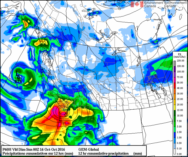
Here’s the Canadian GEM Global for 5 p.m. Saturday:
Here’s the American GFS model for 8 p.m. Saturday:
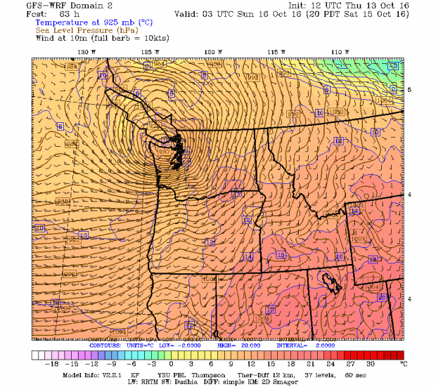
If you look at a meteorological chart of this storm, you’ll notice the isobars, lines of equal pressure, are tightly packed. That’s a clear indication of a steep pressure gradient and therefore very strong, likely damaging, winds, especially in the southern half of the system.
Because there’s still some variability in the storm track it’s important to understand that the storm will affect us on Vancouver Island differently if it shifts a little north or south. If it’s to the south, we’ll escape the worst of it. If it makes landfall on the central island, the strongest winds will towards southern Vancouver Island.
So what does all of this mean for you?
Be prepared. No matter what, it’s going to be a stormy Saturday with strong winds and heavy rain. I’m expecting weather warnings to be issued. Be ready for power outages, downed trees and branches and possibly flooding. If you’re into storm watching and you’re heading to the west coast of the island, know that beaches in the Pacific Rim National Park Reserve might be closed. Seas will be high, with swells expected to 9 meters and until Monday an extreme wave hazard advisory is in effect.
As for the timing of the storm, it approaches late afternoon and evening Saturday. So put away any outdoor patio furniture in the morning! If this storm does what it’s forecast to do, it’ll be one of the most intense storms we’ve seen in many years in the Pacific Northwest. We’ll all be watching!


