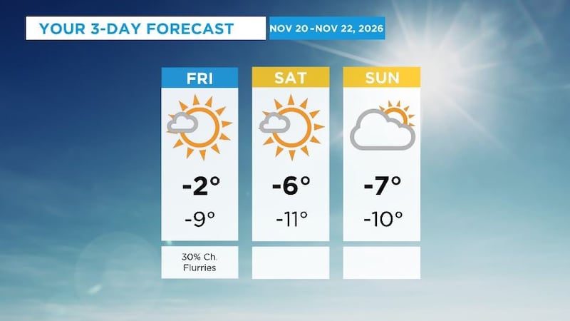
This weekend will be cool with daytime highs in Calgary between -2 C to -7 C and overnight lows between -9 C and -11 C. Light and scattered snow is expected to fall over most of Alberta and portions of B.C. and Saskatchewan. A low-pressure system riding the northern half of the western provinces is grabbing cold air and driving it toward the southern borders, and there is a bit of moisture embedded in that air mass. The bigger story will not be new precipitation but rather the measurable snow and ice on surfaces like sidewalks, parking lots, driveways, side streets, bridge decks, and on and off ramps. There will be more cloud than sun this weekend and that, combined with the below seasonal daytime highs will limit melting. According to 511Alberta, road conditions around central and southern Alberta at 9 a.m. Friday were mostly bare with some areas showing partly covered with snow and ice. Fog was present across southeastern Alberta early Friday and could return in the mornings across the region. Daytime highs will start to trend toward freezing by early next week, and by the middle of the week it is possible Calgary could see daytime highs as warm as 5 C.