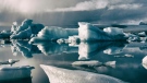
"No big changes on the forecast, other than some warmer temperatures as we get into and beyond the weekend. We continue to be under the influence of a ridge of high pressure. There continues to be activity on the north end of the island thanks to a cold front dropping down from a low based in the Gulf of Alaska. That front will deliver some scattered showers into Tuesday afternoon and evening. Should the front stick around into Wednesday there could be some more showers into the late hours. More bases around the Comox Valley, some inland areas and possibly the Nanaimo area. Once that front moves along we’ll see temperatures bump into the mid 20s by the end of the weekend and beginning of next week."