Did you see the sunrise this morning? The colours were incredible.
According to weather lore, “red sky at morning, sailor’s warning.” There are no official warnings for Vancouver Island, but we do have a head’s up that a change is coming and more wintry weather is on the way!
Special Weather Statement
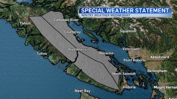
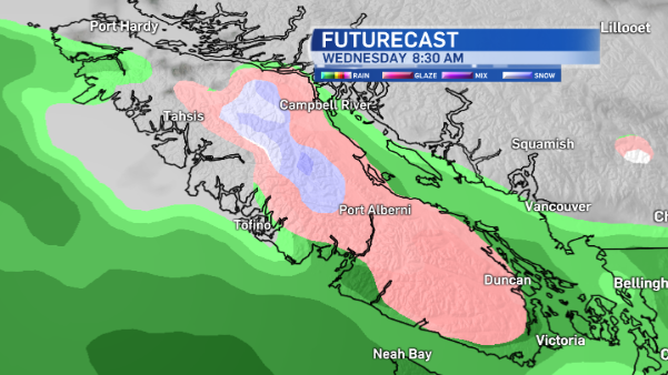
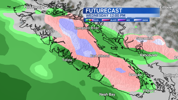
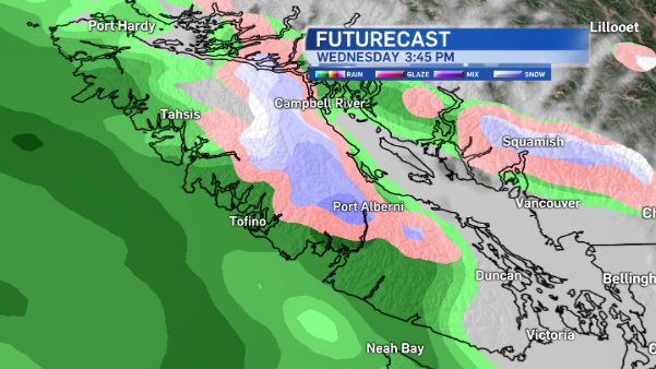
Environment Canada has updated the Special Weather Statement that was issued yesterday for parts of Vancouver Island. A slow-moving front is expected to approach the South Coast tonight.
Cold outflow winds will intensify as it approaches, winds funnelling out to the island from the Fraser Valley and Howe Sound. As the cold air reaches the island, bands of precipitation will sweep across the area.
Rain could be mixed with snow or change to snow at times Wednesday. The pattern continues Wednesday night.
Areas under the Special Weather Statement are East Vancouver Island, Inland Vancouver Island, Whistler, Howe Sound, the Sunshine Coast, and the Fraser Valley
Best chance for snow
Your best chance for snow is at higher elevations. Where cold air is entrenched through the Eastern Fraser Valley, Howe Sound and Whistler, the odds of getting snow is pretty good.
On the island, snowfall is more likely through locations away from the immediate waterfront, and over higher terrain. Otherwise, rain or a rain-snow mix is expected as the front comes through.
If you’re heading to Vancouver or the Lower Mainland, snow isn’t likely to fall.