
After a snowy day on Vancouver Island, skies are clear again, thanks to high pressure building in behind yesterday’s snow storm.
ICYMI: December 19 Island Snow
Bright weather is perfect for this last full day of autumn; a day that will see some of the snow from yesterday melt as temperatures warm up above 5°C in many (although not all!) communities. The winter solstice is tomorrow morning, with the new season officially beginning at 8:28am, December 21. And there’s a slight chance we could get a few flurries to mark the occasion.
Watch for ice
In areas where the snow doesn`t fully melt today, conditions will be icy in the mornings. Compact snow and slush combined with overnight lows below freezing will make for some slippery mornings this week.
Snow? Again?
This weather pattern is a tough one. Right now the computer forecast models are having a tough time agreeing on whether or not conditions will remain dry Thursday night through Friday.
At the higher elevations, if any of the cloud cover sweeping the south island does precipitate Thursday night through Friday, it may fall as snow. Have a look at the Futurecast – your cloud and precipitation outlook through Friday mid-morning. As of right now, conditions look mainly dry through the next 48 hours.
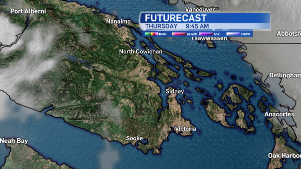
Mainly clear with a few clouds here and there as we get our morning started Thursday.
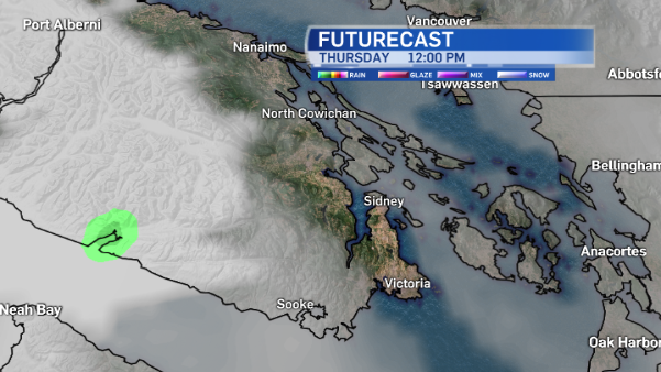
Increasing cloud around lunchtime Thursday.
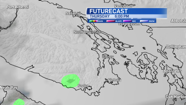
Thursday at 6:00pm, just past Sooke, a hint at a sprinkle of rain.
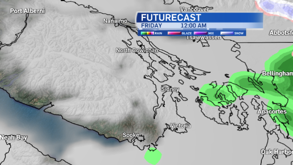
Mainly cloudy at midnight.
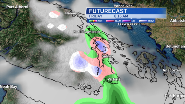
Friday at 8:15am a chance of showers in parts of the Capital Region with a rain/snow mix possible along the Pat Bay Highway, flurries over to Salt Spring Island and at the Malahat.
My point is, this is a day-by-day forecasting situation. Even through the weekend and Christmas Day. There are some big inconsistencies in the forecast models as we look towards the weekend. For the Victoria area, the only thing that lines up is a dry Saturday. So late minute Christmas shopping should be a breeze!
White Christmas?
The forecast for Sunday, Christmas Eve Day, is all over the place. The GFS model suggests snow changing to rain mid-day Christmas Eve, and showers Christmas Day as temperatures warm up. The GEM is calling for temperatures to stay cold and a wicked dump of snow and ice pellets Christmas Eve through Christmas Day. The ECMWF shows dry weather for Christmas Eve day in the Capital Region, but by Christmas Day, rain in downtown, a rain/snow mix in the West Shore and snow over the Malahat.
Sigh. The life of a meteorologist. Sometimes it’s so totally obvious. Other times it isn’t and the atmospheric conditions are really complex. Know that this weather is highly variable with so many factors influencing the conditions, weather will likely be quite different from town to town on the island through Boxing Day.
I’ll keep you posted!


