
Following a pleasant Victoria Day long weekend, this afternoon is boasting temperatures in the 20s…again!
Most people aren’t complaining. Skies are clear and summertime conditions seem like they’re not going away.
So far, the month of May has been drier and warmer than average. In Victoria alone daytime highs have averaged 18.6°C so far this month, above the seasonal normal of 17°C. And as far as rain goes, 3.4 millimeters this month is way below normal.
We typically get a little more than 35 millimeters of rain in May. The last few days of the month won’t boost the rain tally. Warm, dry conditions are here for at least another week.
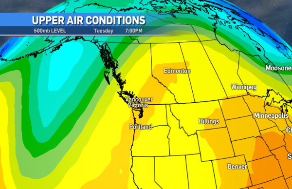
A ridge of high pressure is cranking up the heat through many parts of the province. The dome of warm air stretches from east of Tofino to just south of Prince George. Temperatures are expected to be close to 30°C in the Fraser Canyon, Okanagan and Thompson regions, among others.
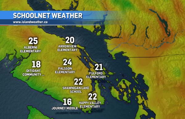
On the island expect temperatures in the low to mid 20s through most communities, peaking in the high 20s through inland towns. The west and north island, as usual, will be slightly cooler, in the mid to high teens.
The ridge shifts east a bit tomorrow and Thursday, with warm air remaining in place Wednesday, but temperatures cool a bit Thursday.
Fog patches could develop in some coastal areas (mostly in the overnight hours) along with drizzle on the west coast in the next couple of days. As the high pressure ridge continues to shift eastward, an upper trough of low pressure moves in from the Pacific Friday-Saturday.
That’s when we’ll see a little more cloud and conditions will return to seasonal average. The only area that appears to be at risk of some real rain in the next week is Port Hardy, but even that looks like it’ll hold off until the weekend.


