Vancouver Island snowfall to begin this weekend, but exact totals unclear
It’s Friday and there’s a good chance that you’ll order dinner in. If you’re like myself and my fiancé, the ordering process can be frustrating. You go over several options, taking in all the information, and then go back and forth on a decision several times before just making a grilled cheese sandwich and going to bed.
The forecast for the upcoming snow acted the same way this week. Now we sit with the grilled cheese snow-wich, and hope it was the right choice to satisfy us.
Preambles aside, it has been a very back and forth week on trying to nail down the timing and amount of snowfall coming to Vancouver Island at the end of this weekend and through the bulk of next week.
Here’s what we know for sure: A blast of cold Siberian air will take over Western Canada and many parts of the Southern States. This is the coldest air on the planet, with Siberia hitting -61 C at one point last week.
Thankfully, it won’t be that cold, but we’ll get our share of chill next week. As we sit in the cold, any moisture introduced to the area will be in the snow category more than any other moisture category.
The picture below shows that by next Friday we’ll push the cold air out and return to more seasonal temperatures, along with rain.
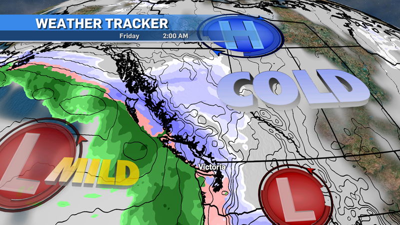 A weather model looking forwards to Friday, Dec. 23, is shown. (CTV News)As I write this article, the models are still arguing about timing and amounts. Here’s how I see it playing out, and remember these numbers are subject to change, especially the mid-week ones.
The cold air will really take over Sunday night into Monday. We have a system moving in and snow will start Sunday evening rolling through Monday morning and a good portion of the afternoon.
Greater Victoria can expect five centimetres into the morning hours and another three to five centimetres during the day. Daytime highs on Monday will keep below 0 C through most island regions and will stay there until Wednesday or Thursday.
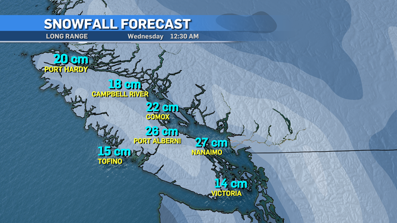 A long range weather model is shown, though exact snowfall totals are subject to change. (CTV News)
North of Greater Victoria in the Mid and North Island, the usual snow-laden areas will see more snowfall, but again there’s a lot of arguing going on with the models.
As of Friday, no special weather statements, watches or warnings have been issued for Vancouver Island. I expect that to change into the weekend for the island.
Tuesday and Wednesday could be another troublesome timeframe but we’ll have to take a "wait and see" approach. This really is a day-by-day, if not hour-by-hour, process to forecast.
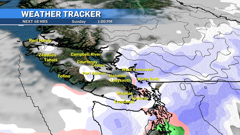 A weekend weather model is shown. (CTV News)
With all the factors going into the forecast, it’s truly a boom or bust scenario for the Pacific Northwest. Some snow lovers will be disappointed, non-lovers may get what they want with small totals and minimal impact.
Prepare for Monday morning snow for now and then after that check in for the rest of the week and what it could bring. Also have yourself a nice grilled cheese sandwich, it’s comfort food during a small blast of winter.
CTVNews.ca Top Stories

From essential goods to common stocking stuffers, Trudeau offering Canadians temporary tax relief
Canadians will soon receive a temporary tax break on several items, along with a one-time $250 rebate, Prime Minister Justin Trudeau announced Thursday.
No evidence linking Modi to criminal activity in Canada: national security adviser
A senior official says the Canadian government is not aware of any evidence linking Indian Prime Minister Narendra Modi to alleged criminal activity perpetrated by Indian agents on Canadian soil.
Trump chooses Pam Bondi for attorney general pick after Gaetz withdraws
U.S. president-elect Donald Trump on Thursday named Pam Bondi, the former attorney general of Florida, to be U.S. attorney general just hours after his other choice, Matt Gaetz, withdrew his name from consideration.
Second Australian teen dies in tainted alcohol case in Laos that has killed 6 tourists
A second Australian teenager who fell critically ill after drinking tainted alcohol in Laos has died in a hospital in Bangkok, her family said Friday, bringing the death toll in the mass poisoning of foreign tourists to six.
A one-of-a-kind Royal Canadian Mint coin sells for more than $1.5M
A rare one-of-a-kind pure gold coin from the Royal Canadian Mint has sold for more than $1.5 million. The 99.99 per cent pure gold coin, named 'The Dance Screen (The Scream Too),' weighs a whopping 10 kilograms and surpassed the previous record for a coin offered at an auction in Canada.
Canoeist is paddling the 9,650-kilometre Great Loop out of gratitude for life
Peter Frank has paddled from Michigan's Upper Peninsula in June to the Chesapeake Bay in Maryland this month in his 1982 Sawyer Loon decked canoe, but he’s still got a long way to go.
More than 70K Murphy beds recalled across Canada, U.S. over tipping concerns
A popular series of Murphy beds that had been sold online is under a recall in Canada and the U.S. after several reported instances of the furniture detaching from walls.
She thought her children just had a cough or fever. A mother shares sons' experience with walking pneumonia
A mother shares with CTVNews.ca her family's health scare as medical experts say cases of the disease and other respiratory illnesses have surged, filling up emergency departments nationwide.
Meta fights CRTC, refuses to publicly release info on news blocking measures
Meta is refusing to publicly disclose information that could determine whether it is subject to the Online News Act despite blocking news from its platforms.


