
Winter may be behind us, but that doesn’t mean a few flurries can’t pop up on Vancouver Island! Early spring snow is fairly common, but it doesn’t mean we like it…
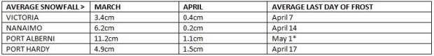
Data from Environment and Climate Change Canada. *Date from www.plantmaps.com
The weather patterns that round out this week are complex, to say the least. It’s best to break this down, one element at a time.
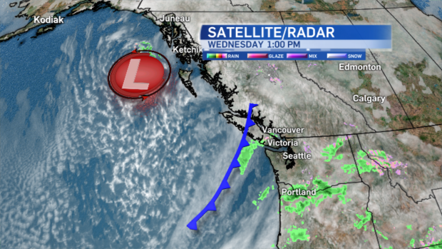
There’s a low digging in off the coast of Haida Gwaii. As it intensifies, the flow of air turns southerly. That allows the moisture-laden warm systems currently anchored off the coast of California to sweep into southern B.C. So that’s the moisture source and the reason for all the precipitation in the coming days.
But wait, there’s more.
A cold front currently over the northern half of Vancouver Island keeps the bulk of the rain there tonight, as it slowly creeps northeastward in response to the Alaskan low.
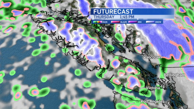
Thursday starts out milder as a low off to the southwest brings strong, warmer winds our way, but mid-day the cold front associated with the system brings the mild push to an end. Temperatures will fall during the day. Freezing levels will drop abruptly, too which allows for rain to change to wet snow in some areas, especially higher elevations.
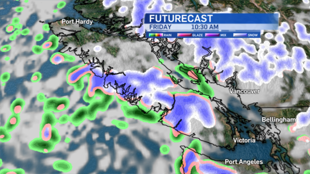
Friday remains unsettled and cooler than seasonal average. Temperatures should max out around 11°C this time of year. We’ll be lucky if we warm up to 7°C. Fortunately by the weekend temperatures rebound and conditions improve.


