
If this doesn’t signal the end of summer, I don’t know what does. it snowed at Mount Washington overnight!
Freezing levels are around 1,500 meters right now thanks to low pressure aloft delivering cool and unsettled conditions. Fortunately at sea level it’s not freezing. That would be a tragic way to wrap up the last few days of summer!
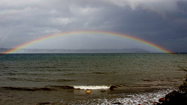
A day of unsettled weather ended with a rainbow, seen here between Courtenay and Royston. Photo by Tanja Kerr
That said, Fall has definitely arrived early! Today temperatures are cool, skies are cloudy, showers are expected throughout the day with occasional sunny breaks, and there’s even a risk of thunderstorms for some island communities.
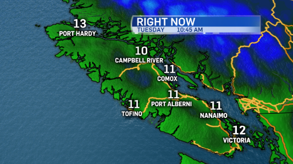
Let’s start with the cooler-than-average temperatures. This morning Port Hardy is warmer than Victoria!
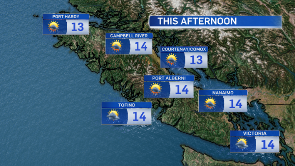
This afternoon temperatures will warm only to the mid-teens, well below the seasonal average of 18°C .
As for the thunderstorm risk, there’s a chance of some convective activity through inland and east Vancouver Island communities late this afternoon.
And, in case you’re wondering, at Mt. Washington there’s a good chance of another dusting of snow late tonight.
For people hanging on to any last bit of summer there is some good news. Conditions begin to clear overnight as high pressure returns. That means temperatures will rebound to seasonal average Wednesday through Friday as we enjoy some more sunshine.


