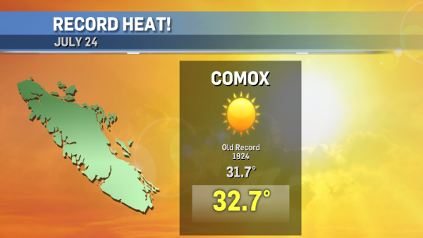
Tuesday was a hot day all over the south coast of B.C., but only one area broke a temperature record – the Comox Valley.
The Courtenay-Comox area reached 32.7°C at 4 p.m. yesterday, smashing the previous record of 31.7°C set in 1924; a record that has been in place for nearly 100 years!
The hot weather is expected to continue until at least early next week. Environment and Climate Change Canada issued a Heat Warning earlier this week for east and inland Vancouver Island, Greater Victoria and the Southern Gulf Islands. It remains in effect today.
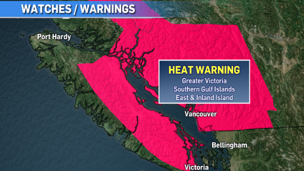
Temperatures are expected to soar to around 29°C through Greater Victoria, the Southern Gulf Islands and east Vancouver Island under this weather pattern. Conditions will be hotter through inland Vancouver Island, with conditions reaching the mid-30s.
While temperatures like these are not unusual during summer months, the duration of the hot spell is. An offshore ridge of high pressure is anchored in place, so this hot stretch looks like it’ll continue through early next week. Along with high heat during the day, temperatures are warm overnight, cooling only to the mid-teens in most areas under the Heat Warning.
What prompts a Heat Warning?
Environment and Climate Change Canada only issues a Heat Warning in our area when “2 or more consecutive days of daytime maximum temperatures are expected to reach 29°C or warmer and nighttime minimum temperatures are expected to fall to 16°C or warmer.”
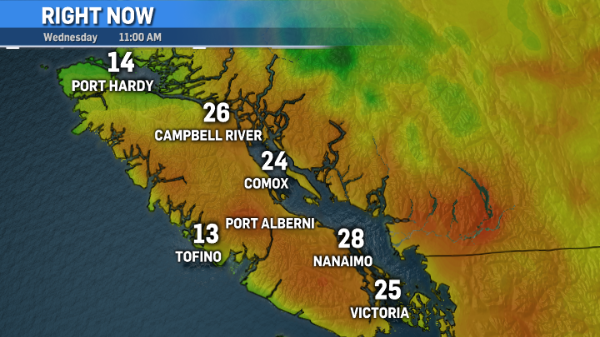
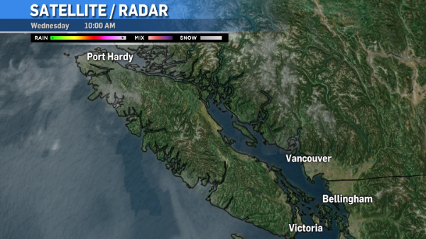
Need to beat the heat? It’s cooler along the west coast and near north Vancouver Island. This morning fog was hugging the west coast and northern tip of the island.
As a result, temperatures are cooler in those areas. Spots like Tofino can expect clearing near noon, while it may be mid-afternoon before the sun breaks through up around Port Hardy.