Very light ash is falling over parts of the Capital Region as wildfire smoke once again blankets the island. Is it a back-to-school omen? Perhaps not, but it’s what everyone’s talking about today.
Light ash falling in downtown Victoria, along with the return of forest fire smoke and the red sun #yyj pic.twitter.com/QmI9oiMCBI
— Ryan Price (@RyanPriceCFAX) September 5, 2017
Very tiny bits of ash falling around Victoria. #yyj #yyjtraffic #wildfires
— Rob Freeman (@robfreemanYYJ) September 5, 2017
For the second time this summer, smoke from the many wildfires burning in Washington State and the interior of B.C. is thick in the sky over the island, prompting the Ministry of Environment and Climate Change Strategy and Island Health to issue a Smoky Skies bulletin for Vancouver Island and the Southern Gulf Islands.
As winds, temperatures and fire behaviour change, smoke concentrations will vary widely from town to town, city to city. No matter where you are, expect the smoke to cause poor air quality. That’s why Vancouver Island is also under an Air Quality Advisory.
The Air Quality Health Index shows deteriorating conditions through Wednesday, especially in Victoria.
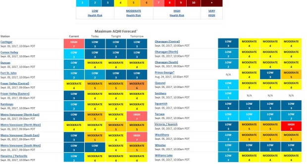
Credit: BC Air Quality
More information on air quality and how the smoke may affect your health is available here: www.bcairquality.ca.
Heat
The hot weather continues today on the island, with daytime highs well above seasonal average.
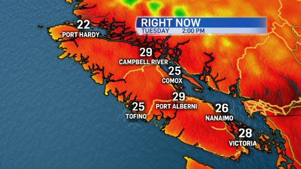
If the smoke wasn’t covering the sky, temperatures would have been at least a few degrees hotter! The cooling effect of the smoke is certainly noticeable, especially at the waterfront. That’s some comfort to some people who find temperatures in the 30s unbearable.
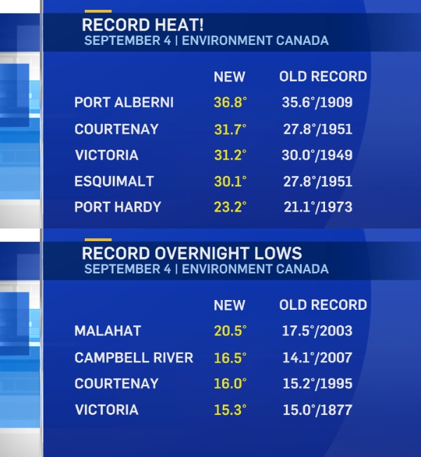
Today’s heat and humidity follows a record hot Labour Day. Not only did we break maximum daytime temperature records September 4, many communities had record warm overnight lows.
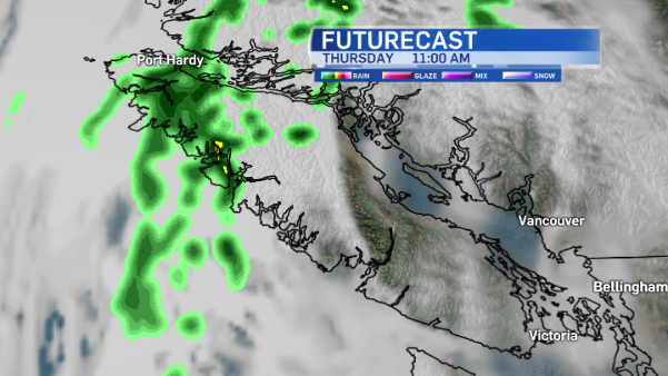
Rain on the way
There is some relief in sight. The ridge of high pressure responsible for the late summer heat looks like it will drift eastward Wednesday-Thursday allowing winds to clear away some of the smoke. Cooler marine air will invade once again along with some clouds, and the north island will get some showers as early as Thursday morning. By the weekend most of the island will have had scattered showers or rain.