
If you weren’t asleep when the thunderstorms rolled through last night, chances are they woke you up!
The first weekend of summer wrapped up in dramatic fashion as an unusually strong summertime cold front swept across Vancouver Island and Washington state late Sunday. The night sky was bright with lightning, the usual nighttime silence was broken by loud, rumbling thunder, and the rain poured down.
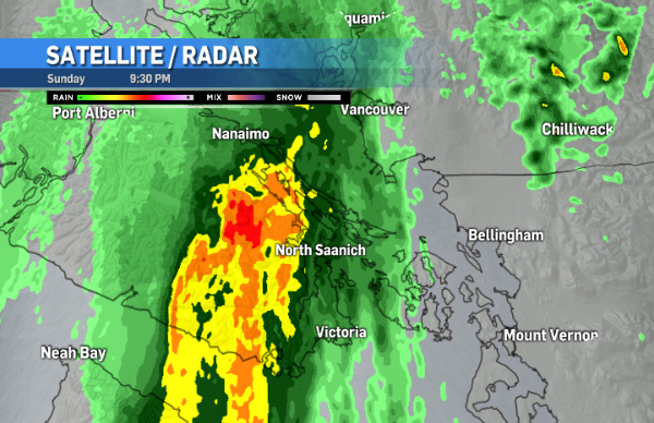
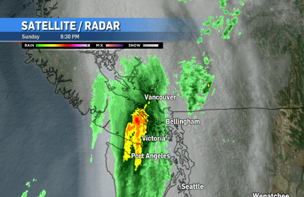
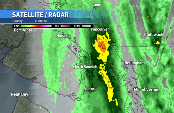
The radar image for 9:30 p.m. – when the storms reached the southern tip of Vancouver Island – shows the heavy rain in areas of yellow and red. By midnight it was all over, at least for Vancouver Island, as the stormy weather tracked east.
Hundreds of lightning strikes were detected from Vancouver Island to the Lower Mainland to Washington State.
Hourly lightning animation from last night's cold front - 9:30 pm to 6:30 am Monday June 25. #BCstorm pic.twitter.com/8u2dvDyCP9
— ECCC Weather BC (@ECCCWeatherBC) June 25, 2018
Here’s what the University of Washington’s regional lightning detection network picked up in the 24 hour periods between Sunday at 1:00 a.m. and Monday at 1:00 a.m.
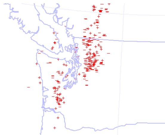
Source: University of Washington
The light show didn’t disappoint!
The skies were angry last night.... My cams picked up a LOT of strikes. Here are a few... @NWSSeattle @ScottSKOMO @ShannonODKOMO @rtmarriott @MorganKIRO7 @NickAllardKIRO7 @MJMCDERMOTT @WunderCave @WeatherNation @StormHour
— Skunkbayweather (@Skunkbayweather) June 25, 2018
HD Link: https://t.co/Q7Hc3w3dLs pic.twitter.com/CPjpoqSa9Y
Roof time lapse of a turbulent looking sky to our southwest earlier this evening as thunderstorms were forming around the area. #wawx pic.twitter.com/ORBvJnOr4J
— NWS Seattle (@NWSSeattle) June 25, 2018
Home from all the #SeattlePride antics and flashes of light in the distance caught my eye!
— Paul Britton (@paulstorms) June 25, 2018
Lightning in the frontal band heading east towards #Seattle. pic.twitter.com/slKbdxlFXN
This one lit up the whole sky for a second! @NWSSeattle pic.twitter.com/pL8GwYhqgP
— Paul Britton (@paulstorms) June 25, 2018
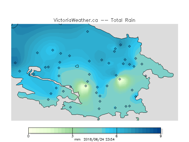
As for rain, it came down fast and furious during the storm hours. This image from School Based Weather Station Network shows the total rainfall in the Greater Victoria area Sunday, up until midnight.
All this happened because the cold front was pretty strong, stronger than usual for this time of year, and instability was elevated. So when the front’s upward motion released the energy, conditions were perfect for thunderstorm development. Usually a cold front at this time of year sends cooler marine air onshore, but with higher amounts of Convective Available Potential Energy (aka CAPE), we got an evening of dramatic weather.
The chatter on social media focused a lot on how rare it is to have thunderstorms on Vancouver Island. Statistics from Environment and Climate Change Canada back that up. A study conducted between 1999 and 2013 shows that, on average, we only get a few days of thunderstorms every year on the island:
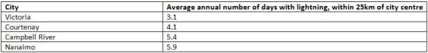
Source: Environment and Climate Change Canada
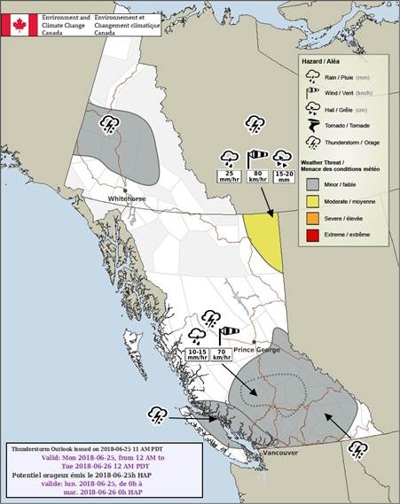
There’s still a risk of thunderstorms on the island today. East Vancouver Island has the best chance of thunder and lightning, even though convective weather can’t be ruled out elsewhere on the island.
The rest of the week is fairly standard for this time of year: Partly cloudy with sunny breaks, occasional showers and temperatures around seasonal average. Once we get through today, I think we’re done with the weather drama for at least little while!


