
The northwesterly wind that is whipping across the Maritimes diminishes into Wednesday. A coastal storm looks like it will be a near miss for the region Thursday into Friday.
Wicked wind
The slow-moving winter storm hammered the Maritimes with peak wind gusts of 60 to 100 km/h Monday into early Tuesday morning. A few areas recorded gusts exceeding 100 km/h, including the Yarmouth Airport in Nova Scotia with a gust of 139 km/h, and North Cape in Prince Edward Island with a gust of 104 km/h.
The severe wind contributed to power outages, travel delays, and school closures.
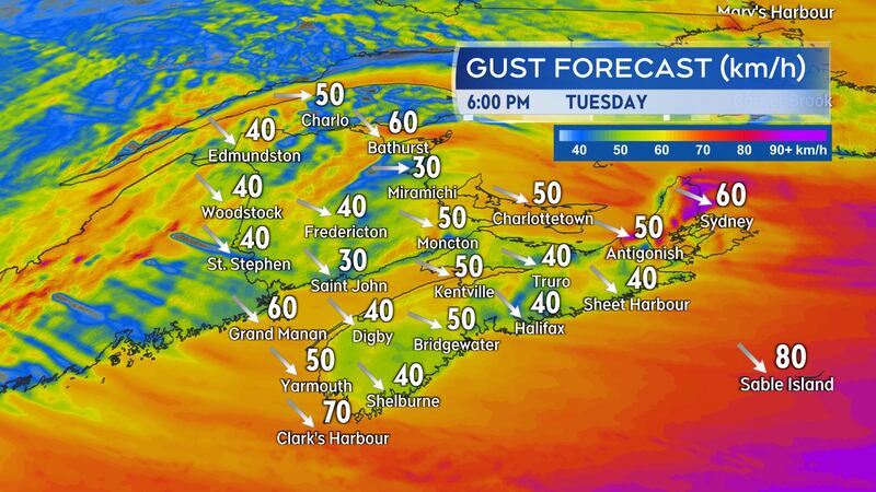
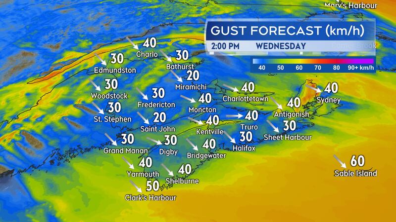
As the centre of the storm continues east across Newfoundland, the wind will gradually diminish across the Maritime provinces. Peak gusts are expected to be in the range of 40 to 70 km/h by early Tuesday evening, 30 to 60 km/h by midnight, and then 30 to 50 km/h through the day on Wednesday.
The wind will continue out of the northwest, so temperatures will be kept cold in the Maritimes for Tuesday night and chilly on Wednesday.
As the wind eases, so will any remaining areas of blowing and drifting snow.
Snow squalls continue in Cape Breton
Snow squalls impacted a number of areas in the Maritimes Monday night into Tuesday morning. Very poor visibility was reported for periods of time in northern New Brunswick, the Annapolis Valley, Cape Breton, and parts of Prince Edward Island.
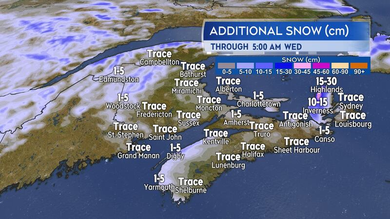
The risk of further snow squalls diminishes for most of the Maritimes by Tuesday evening. The risk of snow squalls does continue for Inverness and Victoria counties in Cape Breton into early Wednesday morning.
The Cape Breton Highlands remains under a winter storm warning with additional snow amounts of 25 to 45 centimetres possible Tuesday through Wednesday morning.
Late week coastal storm
A low-pressure system across the U.S. Gulf States will develop into a full-blown storm as it moves north of the Carolinas Thursday morning. The storm being directed around a large high-pressure system that will be centred near the U.S. Midwest.
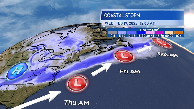
Current forecast guidance shows the storm passing just far enough east of Nova Scotia Thursday night into Friday to keep the heaviest snow offshore of the Maritimes.
The projected miss is too close for comfort though, especially for Nova Scotia. It wouldn’t take much of a shift to the west for that province to potentially be impacted by heavier snow and stronger winds. It is strongly recommended to continue to monitor the forecast for Thursday night into Friday.
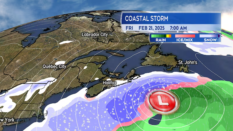
Some of the guidance has the heavier snow and stronger winds with the system coming within 25 to 50 km/h of the Atlantic coastline of Nova Scotia.
Eastern areas of Newfoundland, including the Avalon Peninsula, will also have to watch for possible inclement weather brought on by the storm as it moves towards the North Atlantic on Friday.


