A fast-moving band of snow will cross the Maritimes Thursday night. A gusty, colder west wind returns behind for Friday.
Snow timing and amounts
The first of the snow should reach southwestern New Brunswick and southwestern Nova Scotia by nearly 3 p.m. Thursday.
The snow will develop, west-to-east, very quickly through Thursday evening. The snow should reach Fredericton by 5 p.m., Halifax by 6 p.m., and Charlottetown by 7 p.m. The snow is expected to clear in western parts of the Maritimes around midnight and a few hours later in eastern parts of the Maritimes.
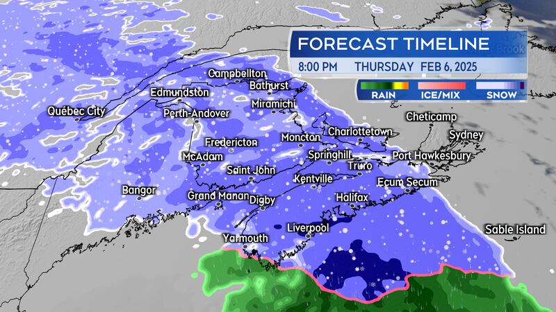
Snowfall rates are expected to be in the range of one-to-three centimetres an hour. That means it won’t take long for snow to accumulate on surfaces such as roads. Motorists can expect to contend with snow-covered and slippery roads Thursday evening and night.
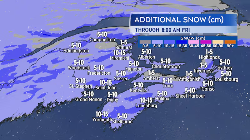
Most of the Maritimes should expect to pick up five-to-10 cm of snow. Locally higher snow amounts of 10-to-15 cm are possible, particularly in southwestern Nova Scotia.
Scattered flurries are expected through the day on Friday.
Gusty winds and temperature fluctuation
A southerly wind with gusts of 20 to 50 km/h is expected to accompany the snow. The southerly wind will push temperatures to just above freezing for southern New Brunswick, Nova Scotia, and Prince Edward Island by early Friday morning.
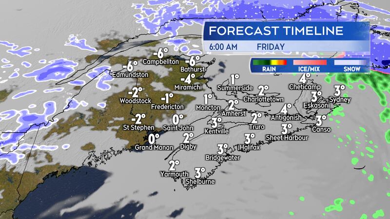
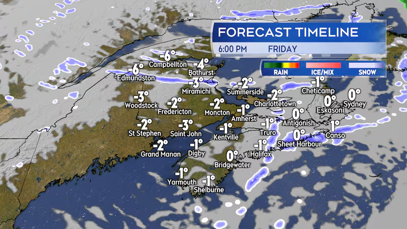
The wind will become westerly on Friday, with peak gusts of 40 to 60 km/h. The westerly wind returning colder air and those areas that start Friday above freezing will fall back below by late afternoon and evening. Watch for any wet or slushy surfaces to turn icy.
Northern Inverness County in Cape Breton is under a wind warning. Thursday overnight and early Friday morning peak SE gusts could reach near 100 km/h; the stronger wind is a result of the topography of the Cape Breton Highlands.
Snow still possible Sunday
A second Colorado Low is expected to exit the northeastern U.S. and move south and east of Nova Scotia on Sunday.
Over the past 24 hours there has been some movement in computer weather models for the system that would hold some of the heaviest snow just offshore. It is common to see some back-and-forth on snow amounts with computer guidance this far out of the expected start of the snowfall.
I would certainly recommend continuing to monitor the forecast for Sunday in the Maritimes, particularly if you are planning to travel through Nova Scotia that day.