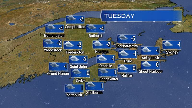
It will be cold and cloudy with some rounds of flurries in the forecast for the Maritimes this week. Overnight low temperatures this week will generally be several degrees below freezing. Daytime high temperatures will be near to a few degrees below zero.
Wednesday night into Thursday morning looks to be the coldest night of the week for many, especially for northern and western New Brunswick, where some polar-sourced air moving across the continent will break in. Northern and western areas of New Brunswick could see temperatures dip into a range of -14 C to -20 C early Thursday morning.
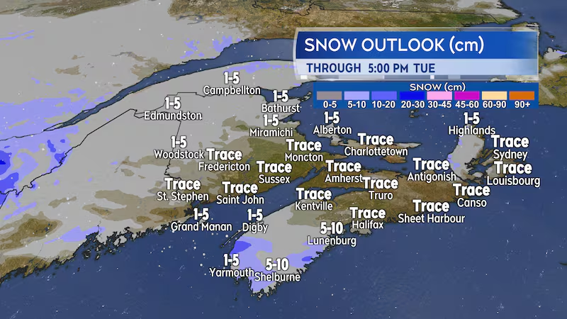
A weak low-pressure system will move across the Maritimes on Tuesday, keeping the sky mostly cloudy. Scattered flurries for most of the region shouldn’t amount to much more than a few centimetres of snow.
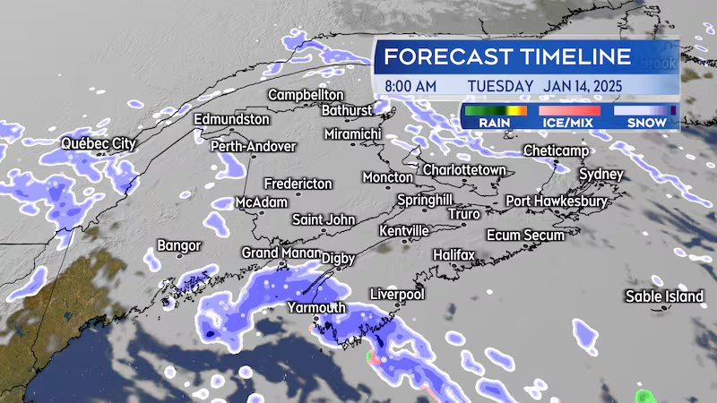
A period of snow will occur in the southwest of Nova Scotia early Tuesday morning through Tuesday afternoon. That snow will develop between 4 and 9 a.m. for Digby, Yarmouth, Shelburne, and Queens counties. It may reduce visibility for periods of time and accumulate two-to-five centimetres.
Behind that snow, additional flurries and snow squalls are expected off the Bay of Fundy for Digby and Yarmouth counties Tuesday evening and night. The flurries and snow squalls could accumulate an additional five centimetres by midnight Tuesday into Wednesday.
Wind on Tuesday will be mostly from the north and northeast. It will not be particularly strong, sustaining 10-to-20 km/h with occasional gusts of 20-to-40 km/h.
The long-range forecast guide indicates a stronger low-pressure system will move across Ontario and into western Quebec this weekend. A brief bump up in temperatures along with a mix of snow and rain for the Maritimes is possible late Saturday into Sunday.


