A weak area of low pressure moving in may be just enough to trigger some snow squalls off the Bay of Fundy Thursday afternoon and night. Any squalls that develop would end by early Friday morning.
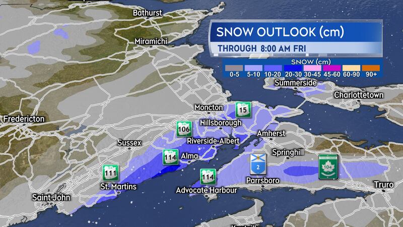
Snow outlook
The areas at highest risk of snow squalls are around the Bay of Fundy shoreline both on the New Brunswick and Nova Scotia side.
The area between St. Martins, N.B., and Cap-Pelé, N.B., has a high chance of snow squalls developing that could bring in localized snow totals of five-to-15 cm. It is possible some of the snow squalls could hold together through the southeast of New Brunswick and move over the Northumberland Strait into parts of western Prince Edward Island. That would include the Summerside area, which could pick up totals of five-to-10 cm in any occurring squalls.
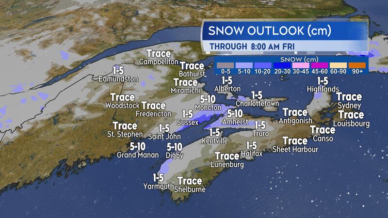
A few other areas to watch include Cumberland and Colchester counties, N.S. In that area, the risk of snow squalls is highest in higher terrain as well as on the coastline of the Minas Basin. A risk of snow squalls producing amounts of five-to-10 cm also spans the Digby Neck and the near coastal areas of the Annapolis Valley.
Most other areas of the Maritimes can expect minimal snow amounts in scattered lighter snow and flurries.
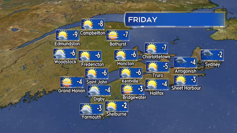
Slight moderation of the cold
Some of the edge comes out of the colder air Thursday night and Friday.
Low temperatures Thursday night are forecast to range -14 C to -18 C in New Brunswick, -10 C to -12 C in Prince Edward Island, and -6 C to -10 C for Nova Scotia. That is up a few to several degrees compared to the last few nights.
High temperatures on Friday -4 C to -9 C for New Brunswick, near -7 C for Prince Edward Island, and -2 C to -6 C for Nova Scotia.
The highest chance of flurries on Friday in southwestern Nova Scotia and in eastern areas of that province, including the North Shore of the mainland and Cape Breton. In both cases the flurries would be brought in by onshore winds off ocean water.
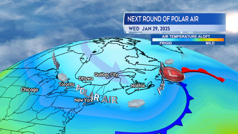
Next cold snap
In the long-range forecast, a cold front is being indicated to move across the Maritimes next Tuesday into Wednesday.
The cold front would be followed by a fresh round of polar sourced air. That next round of colder air won’t be impacting as much of the country as the current cold snap did. Instead, it will be more focused around Ontario, Quebec, and Atlantic Canada as it moves south in a trough, or dip, in the jet stream.
That next round of colder air is projected to be in place for at least Wednesday through Friday of next week.