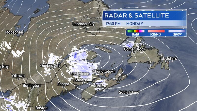
A powerful winter storm lingers in the vicinity of the Maritimes to start this week. Snow continues to add up for some areas as a strong westerly wind continues into Monday night.
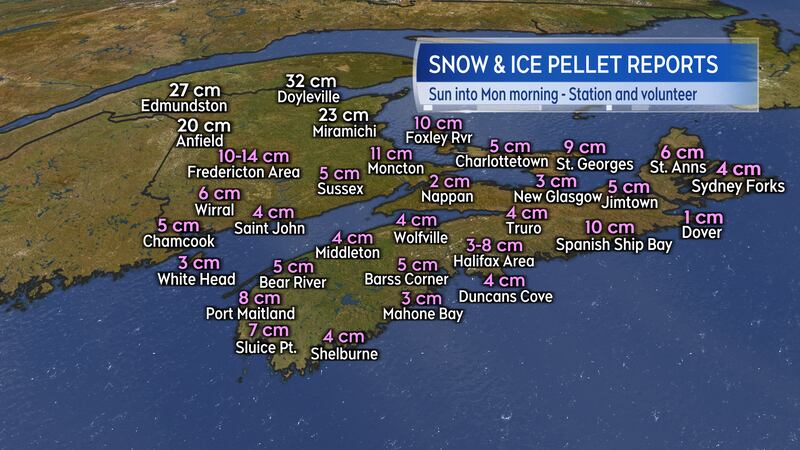
Snow and ice reports
Similar to the storm last Thursday, the latest round of winter weather arrived as a mixture of heavy snow, ice pellets and freezing rain.
The highest snow reports have come from northern New Brunswick and range from 20 to nearly 30 cm. The Fredericton area is reporting 10-to-14 cm of snow and ice pellets.
Much of the remainder of the Maritimes is reporting totals of two-to-10 cm of snow and ice pellets. There was a significant period of freezing rain across Nova Scotia as well.
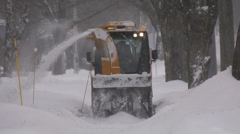
Snow and snow squalls continue
The centre of the storm will slowly shift eastward towards Newfoundland on Monday into Tuesday. The slow movement of the system will produce further areas of snow and flurries for the Maritimes. A number of weather warning remain in effect.
Snow in northern New Brunswick could total another five-to-10 cm by Tuesday morning. Parts of Prince Edward Island and the Annapolis Valley of Nova Scotia could also pick up five-to-10 cm by Tuesday morning in snow squalls. Much of the remainder of the region will have intermittent flurries that could total one-to-five centimetres.
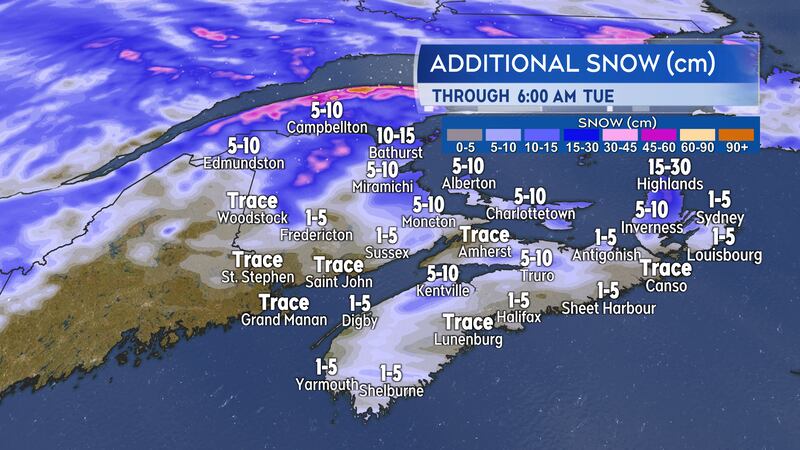
Snow squalls are expected in the Cape Breton Highlands Monday night through Tuesday. Those more intense bands of snow off the Gulf of St. Lawrence could bring 15-to-30 cm of snow into the highest terrain there.
Strong and gusty winds will continue to produce areas of blowing and drifting snow in northern New Brunswick Monday night and Tuesday. Snow squalls in the Cape Breton Highlands, around the Annapolis Valley, Minas Basin, and North Shore of Nova Scotia, and Prince Edward Island are also capable of producing periods of near whiteout conditions. The risk of snow squalls highest Monday through Tuesday afternoon.
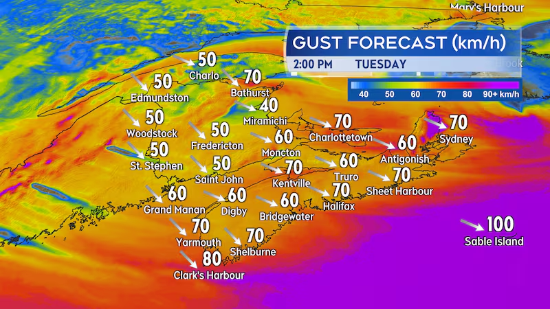
When the wind will ease
The barometric pressure of the storm had fallen to near 965 mb Monday morning, which places it squarely in the category of strongest storms that can be expected during the winter season.
The strong pressure gradient around the storm will drive high and gusty winds. Wind will become west-northwest Monday afternoon across the region with peak gusts of 70 to 100 km/h. The wind will continue strong into Tuesday morning.
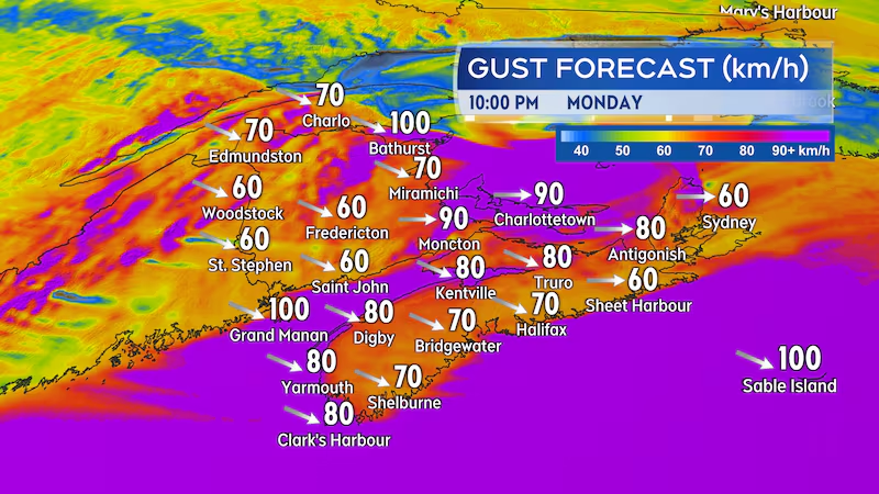
By early Tuesday afternoon the west-northwest wind will have gusts of 50-to-80 km/h except 70-to-90 km/h in Victoria and Cape Breton counties. The wind will diminish further Tuesday evening and night. By Wednesday morning, peak wind gusts will come down into a range of 30-to-50 km/h.