The latest round of polar air to break out across the country continues to produce a variety of winter weather this week.
West Coast snow
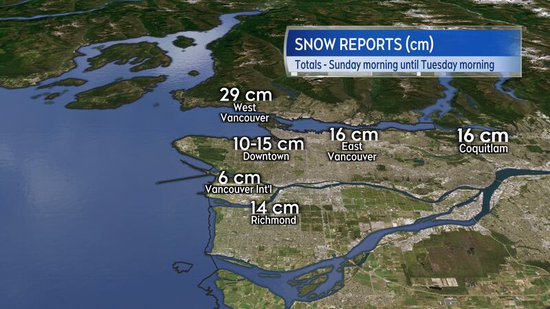
As the cold air flowed through the mountain ranges of B.C. to the coastline, it has led to some unusually snowy conditions for south coastal communities such as Vancouver.
The Greater Vancouver area reported snow totalling between 10 and 30 cm from Sunday morning through Tuesday morning. The amount of snow was heavily influenced by proximity to the coast and higher terrain.
Parts of the province remain under an Arctic Outflow warning. Those areas are expected to experience a wind chill making it feel into the -20s into Wednesday morning.
Prairie cold and snow
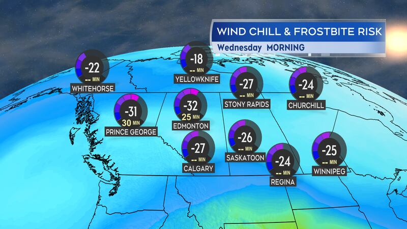
While the extreme wind chills in the Prairies are starting to moderate – and some of the extreme cold warnings issued this past weekend are starting to come to an end – it is still going to be a bitterly cold week for those provinces.
Wind chill will make if feel well down into the -20s and -30s for much of Alberta, Saskatchewan and Manitoba for extended periods of time Tuesday through Friday.
A Colorado Low, which is a low-pressure system that develops on the leeward side of the Rocky Mountain range near that state, will bring 10-to-15 cm of fluffy snow across parts of southern Saskatchewan and southern Manitoba Wednesday into Thursday.
Parts of Ontario and Quebec are expected to receive some wintry weather from that system Thursday into Friday.
Maritimes watching for snow
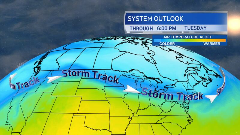
The boundary between the Arctic air and milder air to the south has set up along the jet stream, which is running straight across the U.S. Northwest, to the Great Lakes, and then just south of the Maritimes.
That boundary and jet stream will act as the “storm track” for North America this week. As a pair of low-pressure systems develop near Colorado, they will move eastward along that track.
The first arrives for Thursday evening and night in the Maritimes. It looks to bring about five-to-10 cm of snow through Thursday night. The snow may turn to a period of rain for both Nova Scotia and Prince Edward Island as temperatures come up briefly above the freezing mark. Temperatures return below freezing on Friday so wet or slushy surfaces will turn icy.
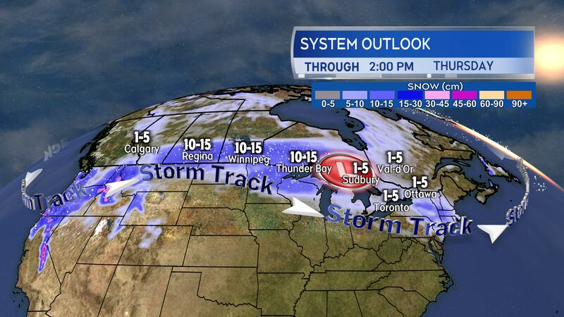
The second low-pressure system is set to arrive on Sunday and is forecast to be the stronger of the two. With the track of that low expected to be south of Nova Scotia, it currently looks like a mostly snow event for the region. It has the higher potential of bringing some parts of the Maritimes snow totals to or exceeding 15 cm.


