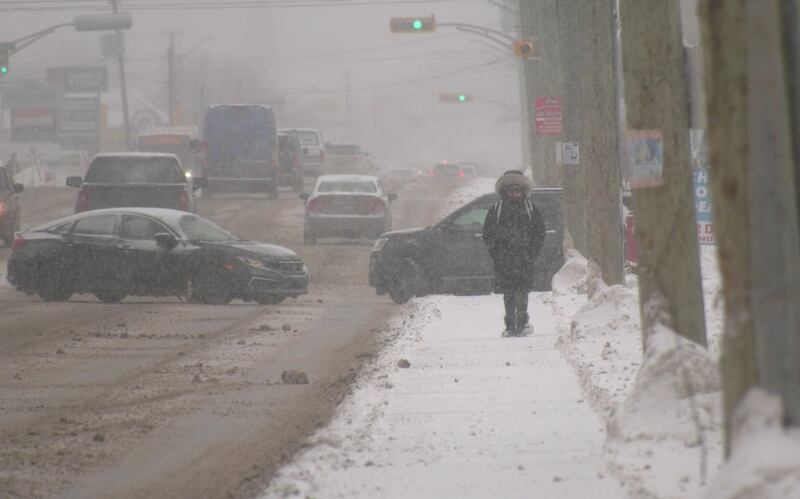
Weather warnings and statements are blanketing most of the Maritimes Thursday into Friday as a snowy, icy system makes its way into the region.
Here’s the latest update on snow totals, icy weather and strong winds across the Maritimes.
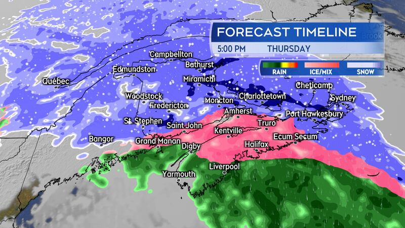
Weather deteriorates Thursday afternoon and evening
Thursday afternoon will see the snow become heavy at times for central and northern areas of New Brunswick. The snow will mix with ice pellets in southern New Brunswick.
Mainland Nova Scotia can expect snow to transition to ice pellets and freezing rain Thursday afternoon. Cape Breton will see snow arrive by late afternoon. The snow is expected to become heavy at times in the evening. A turn to ice pellets and freezing rain is possible late evening and near midnight.
Snow is expected to be falling across Prince Edward Island by 2 p.m. Thursday, with snow becoming heavy at times in the afternoon. A turn to ice pellets with a risk of freezing rain is expected for central and eastern P.E.I. in the evening. However, snow will continue to fall in parts of Prince County.
The wintry mix of weather clears western parts of the Maritimes Thursday evening. The wintry mix will clear eastern areas, including P.E.I. and Cape Breton, near midnight. Lingering flurries are expected overnight and Friday along with a risk of snow squalls in the Cape Breton Highlands.
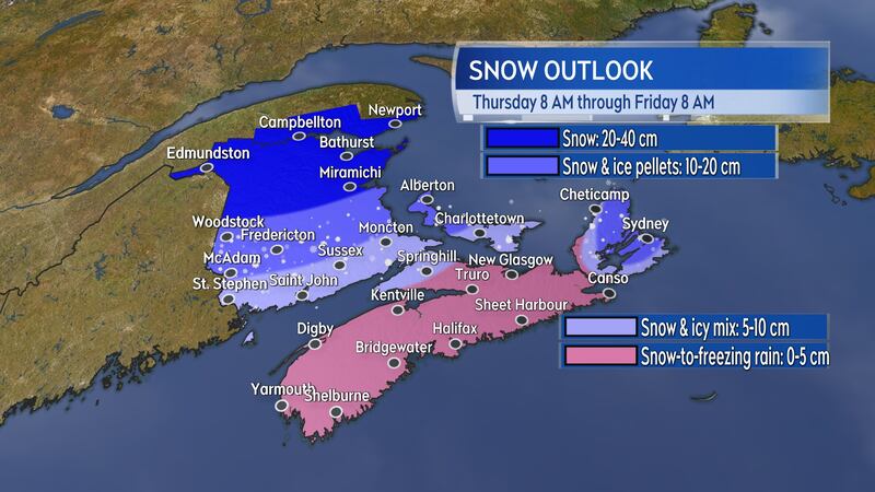
Snow and ice amounts: Most snow expected in northern New Brunswick
The most snow is still expected in northern New Brunswick. Widespread amounts of 20 to 40 cm look likely, that is just below a foot to near a foot-and-a-half of snow. Snow drifts could certainly pile higher in some areas.
Central New Brunswick, western P.E.I., and parts of Cape Breton, including around Sydney and Victoria County, could finish with totals of 10 to 20 cm of snow and ice pellets.
The remainder of P.E.I., Cape Breton, and Nova Scotia’s Cumberland County is likely to see up to 10 cm of snow and ice pellets. The Cape Breton Highlands could pick up further snow amounts of 15-plus cm Thursday overnight and Friday in snow squalls off the Gulf of St. Lawrence.
Mainland Nova Scotia will see up to 5 cm of snow followed by a turn through ice pellets to freezing rain. The period of icy precipitation could last up to four hours. Numerous weather warnings have been issued across the Maritimes.
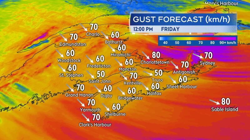
Wicked wind to follow for Friday
Stronger wind gusts of up to 80 km/h are expected to accompany the snow in Cape Breton Thursday evening and night. The wind will likely create periods of blowing snow that could bring visibility down to near whiteout conditions.
Gusts of 120 to 160 km/h are forecast for northern Inverness County in Cape Breton due to the topography of the Highlands. Those exceptionally powerful winds are mostly felt in the area beginning near Cap Le Moine, then north to near Pleasant Bay. The wind strength through that area has been known to be strong enough to tip over transportation trucks and other high-sided vehicles.
The entirety of the Maritimes will be in a very cold northwest wind Friday. That wind will be high and gusty. Widespread gusts peaking 60 to 80 km/h are expected on Friday. Gusts for Cape Breton could peak near 90 km/h.
Ferry sailings between Nova Scotia and Newfoundland are cancelled Thursday night and Friday.
Those areas that see more snow on Thursday, including New Brunswick, western P.E.I., and parts of Cape Breton, will be contending with further areas of blowing and drifting snow Friday.
Expect a wicked windchill to develop on Friday. By the afternoon, most of the Maritimes will feel well down into the minus-teens and minus-20s.