
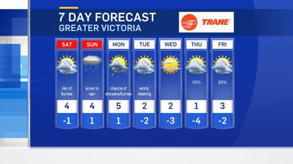
More wintry weather is on the way this weekend.
There will be some clearing tonight, but winds will be gusty, especially near the water. Clouds are helping to moderate the overnight temperatures, but they’ll still be around or below freezing.
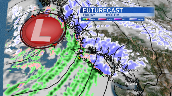
As a low pressure system continues to track over Vancouver Island from the north, snow is expected in several areas throughout the weekend.
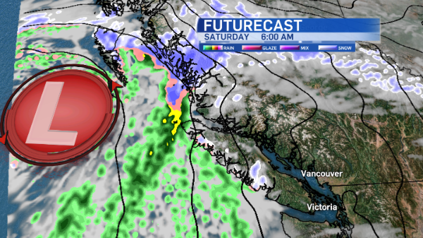
Temperatures will improve slightly as yet another system, this one warm and from the southwest, approaches by late Saturday-early Sunday.
Afternoon highs may be just mild enough to change snow to rain in some areas. We’ll see how that plays out this weekend.
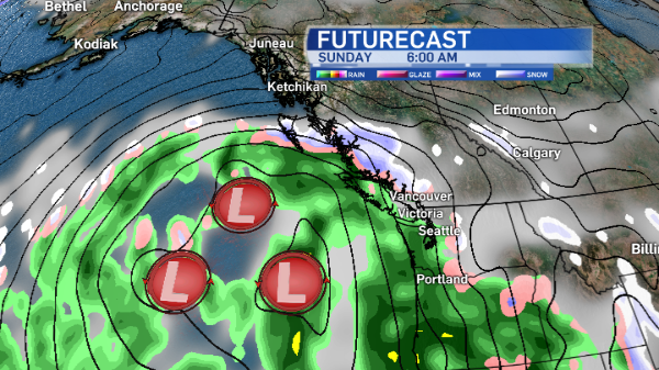
With that mild air moving in, and cold conditions at the surface, a wintry mix of precipitation is expected in many island communities, including freezing rain throughout inland Vancouver Island around Port Alberni on Monday.
At this point there’s some uncertainty about precipitation for next week.
Some forecast models suggest more snow for the island through Tuesday and Wednesday, while others suggestion the arctic ridge will return in full force early next week, clearing skies and funnelling more cold air out to the coast.
For an explanation on how different types of precipitation form, click here.


