Sunday’s sunset as seen from UVic. Islandweather.ca
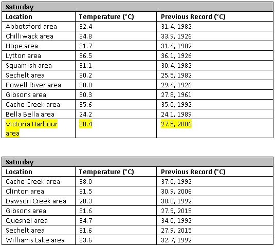
Sunday’s spectacular sunset was the perfect end to the first weekend of summer, a weekend that had temperatures soaring and records falling thanks to a strong upper ridge of high pressure. Across the province temperatures reached well into the 30s both Saturday and Sunday.
More than a dozen records were smashed over the weekend, but only one island location broke a daily high temperature record, according to preliminary reports from Environment Canada.
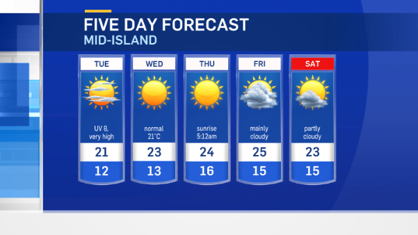
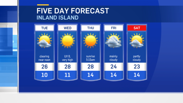
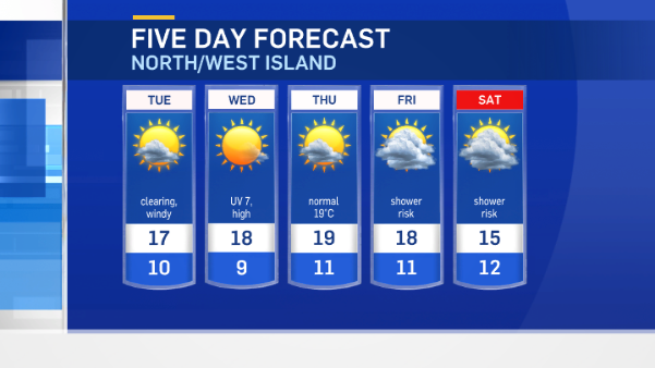
Your forecast
Today temperatures are cooler and closer to normal as Mother Nature has turned on some natural air conditioning. Westerly winds are ushering in cooler marine air, which is returning our temperatures to seasonal average this week.
Most of Vancouver Island will continue to see dry weather through the Canada Day long weekend. Evening and early morning cloudy periods will give way to more sunshine in the afternoons this week.
The only hint of precipitation on the island is pinpointed for areas near Port Hardy on the weekend. The chance of showers for the north island is low, but there may be a few showers developing Friday, Saturday and Sunday amounting to just a few millimeters in total.