
Take a look at this satellite imagery from this morning. You can see the smoke from the wildfires wafting out to the coast.
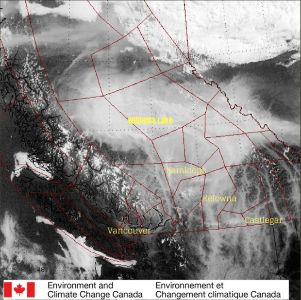
This image was shared on twitter by @ECCCWeatherBC around the same time an Air Quality Advisory was issued for Metro Vancouver and The Fraser Valley Regional District.
The advisory is in effect for at least 24 hours, until the weather pattern changes or the fire activity in the BC Interior improves. The “heads up” comes as a result of high concentrations of fine particulate matter detected in the air over the Lower Mainland.
Details of the advisory: “Fine particulate matter, also known as PM2.5, refers to airborne solid or liquid droplets with a diameter of 2.5 micrometres (μm) or less. PM2.5 can easily penetrate indoors because of their small size. The PM2.5 currently impacting our air shed is primarily smoke that has been transported into our region from wildfires burning in the interior of BC.”
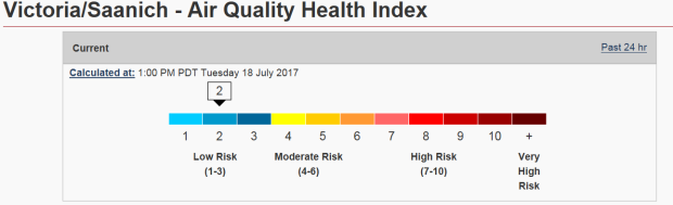
So far, air quality is still OK over Vancouver Island.
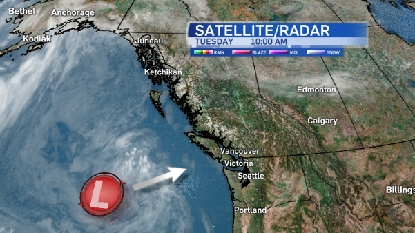
Late Wednesday through Thursday, a weather system will finally reach the island, offering up a little rain, something we haven’t had for a while.
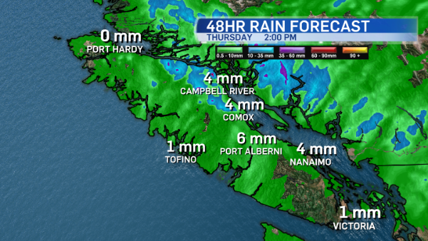
A month without rain
The last time measurable rain was recorded in Victoria was June 18. Could we break the rain-free streak this week? There’s a chance Thursday as a weak disturbances crosses the south coast of BC, offering the threat of showers on Vancouver Island.
At this point it doesn’t look like we’ll get much rain, although many will agree any precipitation will be a refreshing change.
After the brief rainfall, it’s back to sunny skies and hot temperatures. This weekend clears up and temperatures return to the mid-20’s for Saturday and Sunday.


