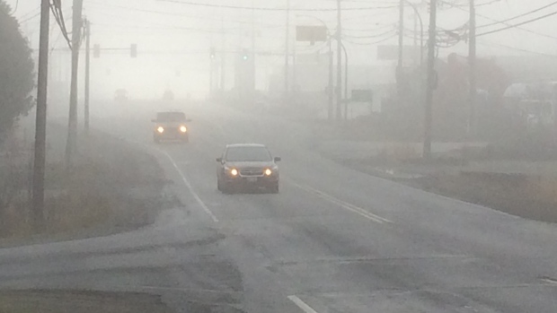
Vancouver Island woke up to frost and lots of fog this morning.
Fog in Campbell River. Dec. 7, 2017. (Gord Kurbis)
Fog on Salt Spring Island. Dec. 7, 2017. (Scott Cunningham)
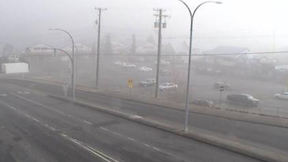
Departure Bay – Zorkin Road in Nanaimo. (Drivebc.ca)
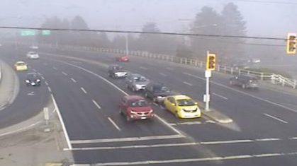
Highway 1 at Comox Road, Nanaimo. (Drivebc.ca)
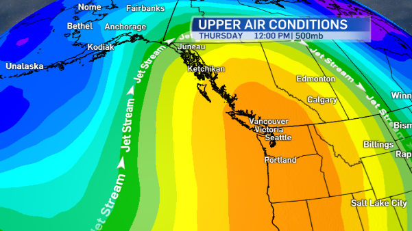
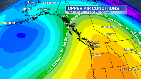
If it wasn’t for the fog, this ridge of high pressure would deliver brilliant, sunny skies to all of Vancouver Island. But under this weather pattern at this time of year, often a thick blanket of fog develops over many parts of Vancouver Island.
The ridge acts like a lid, essentially trapping moisture at the surface. With slack winds, the tiny water droplets that make up the fog don’t mix into the air and dissipate, so the fog remains in place for quite some time.
Environment Canada has issued a fog advisory for east Vancouver Island including areas from Duncan to Nanaimo to Campbell River. Fog is expected to be dense at times, especially near the water. Away from the water, expect fog to become patchy in the afternoons.
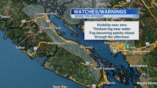
When the fog is this thick, visibility is near zero, which can be dangerous for drivers. Motorists are advised to drive with caution. Fog caused delays for flights and ferries today, and it will likely be a factor tomorrow morning, too.
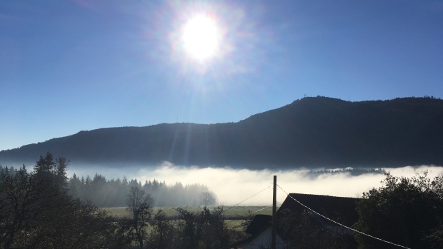
Temperature Inversion
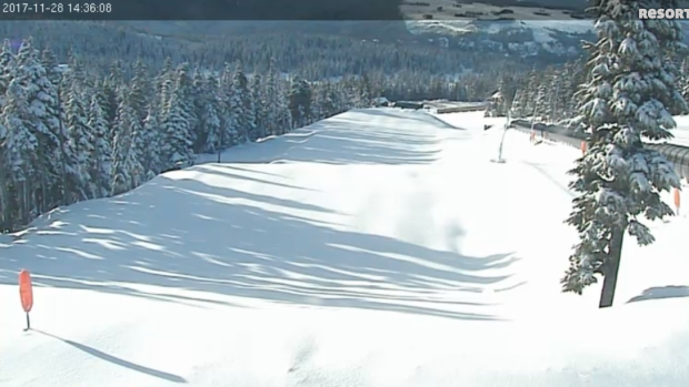
Under “normal” circumstances, temperatures decrease with height. Makes sense, right? The higher you go up a mountain, the colder it is. Well, not under this weather pattern! We have what’s called a temperature inversion. Temperatures are warmer aloft than at the surface. So while the fog hugs the land and shrouds parts of the island in a grey mist, at Mt. Washington, there’s nothing but sunshine and tmeperatures at 10°C before noon!
Air Quality
With stagnant weather conditions, air quality is diminishing in the Comox Valley. An Air Quality Advisory is in effect for Courtenay as high concentrations of fine particulates are expected to persist until there’s a change in the weather.
The advisory was issued by Island Health and the Ministry of Environment. People most at risk of having toruble breathing include those with chronic underlying medical conditions, infants and the elderly. They’re advised to stay indoors in air conditioned spaces to reduce exposure.
In an effort to curb additional pollution in the area, open burning restrictions are in effect for the Comox Valley for the next three days. That means now new fires may be started, or added to, within 15 kilometres of Courtenay City Hall
BCAirQuality.ca has more information on current air quality conditions and restrictions.
When will it rain again?
The intense ridge of high pressure is shifting eastward over the next couple of days, allowing for a weak system to spread some high cloud over the island on the weekend. There’s a slight chance those clouds could bring a few showers to the island Saturday and Sunday. Showers are forecast to be north of Victoria, if they do materialize, amounting to a few millimetres at most. By Monday the ridge strengthens again.