
Today, North Cowichan was the hot spot in the whole country at 8.2°C, but mild temperatures are about to get chilly. Not as cold as they were earlier this winter, but a little cooler. Cool enough to bring a brief bout of snow to the island once again!
As winds shift to a more northerly direction this week, and the jet stream remains farther to the south, sending stormier weather to central and northern California, cooler air takes hold over the South Coast of B.C. That means any precipitation that falls on the island could fall as snow this week, before afternoon temperatures become too mild for water droplets to remain frozen.
The chance of flurries begins at the North Island overnight. Throughout Tuesday there’s a chance of flurries or a rain/snow mix for communities as far south as Campbell River and Port Alberni.
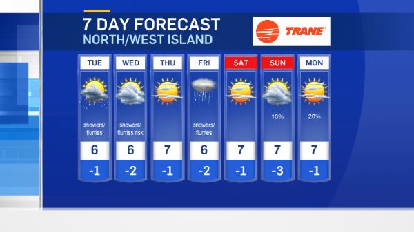
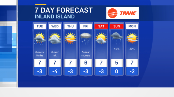
There’s a slight chance of flurries for the Capital Region on Wednesday. The odds are better at higher elevations, through the Westshore and Highlands. Nanaimo too could get some snow mid- week.
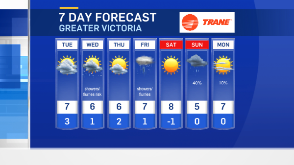
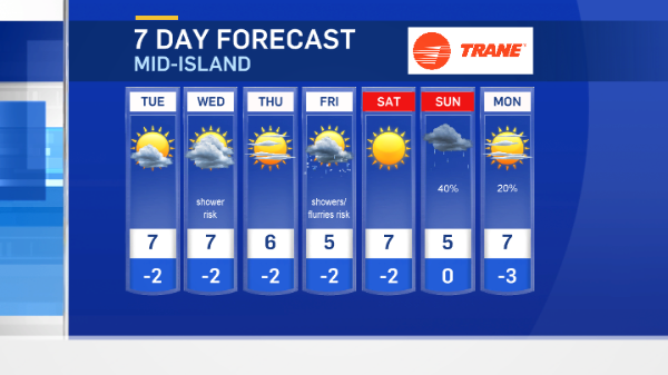
One more round of a rain/snow mix is set for Friday, before a sunny Saturday gets the weekend underway.


