
After another blustery night on southern Vancouver Island, Wednesday starts with sunshine! It's a welcome change after another full day of intense wind and very heavy rain.
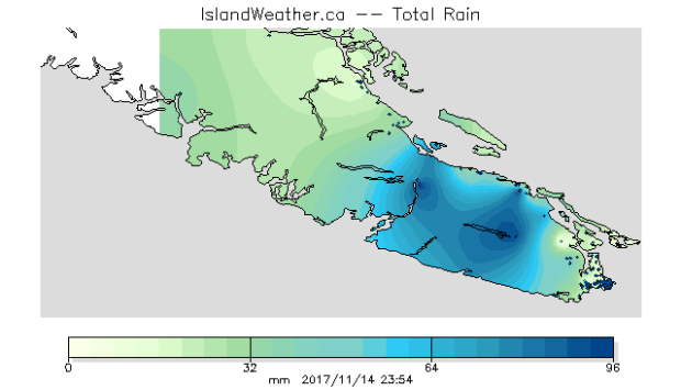
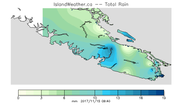
Look at how much rain soaked the island yesterday and overnight. According to the School-Based Weather Station Network, 96 millimetres of rain fell in some mid-island neighbourhoods yesterday! An additional 19 millimetres of rain between midnight and 9:45am today. That's a lot of rain!
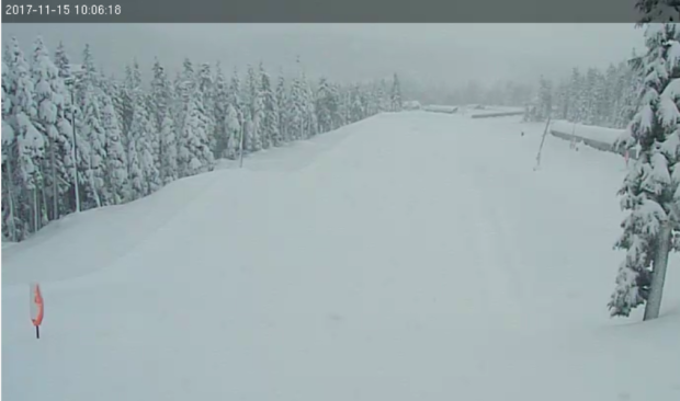
All that rain at sea level...but in the island mountains, it fell as snow! Mount Washington has a thick blanket of the white stuff today...and it's still snowing. Here's the view from the Tube Park Cam. You can watch the weather conditions live, too.
Rainfall warnings for East Vancouver Island have ended for now. Wind warnings for Greater Victoria and the Southern Gulf Islands have ended, too, after a blustery night that had many wondering if trees were going to fall and power was going to go out again.
Peak Winds Overnight (km/h)
Source: Environment Canada
- Saturna Island SSE 109 km/h
- Tsawassen Ferry Terminal SSE 91 km/h
- Howe Sound - Pam Rocks SSE 89 km/h
- Discovery Island SSE 87 km/h
- Victoria Gonzales SSE 67 km/h
- Victoria Airport SSE 67 km/h
- Comox Airport SSE 63 km/h
Today: Still unsettled
Today's weather is much more calm, except for some lingering showers, a little wind at times, and a slight chance of thunderstorms on the island. Looking ahead, in the Greater Victoria area conditions dry out for the next few days, with just a slight chance of showers Thursday and Friday. Otherwise we're looking forward to mainly to partly cloudy conditions with sunny breaks through Saturday. We've earned it!


