
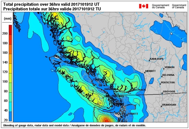
This is why they call it the “wet” coast. This image from Environment and Climate Change Canada says it all! Yesterday’s storm was intense. Here’s a look at the storm, by the numbers, on Vancouver Island. Again, this preliminary data is from Environment and Climate Change Canada.
Storm total rainfall
- Bowser: 61 mm
- Heritage Mountain: 86 mm
- North Cowichan: 57 mm
- Port Alberni: 61 mm
- Tofino Area: 84 mm
Peak winds over the Strait of Georgia area
- Chrome Island: SE 78 gust 104 km/h
- Merry Island: SE 65 gust 81 km/h
- Point Atkinson: E 63 gust 94 km/h
- Sisters Island: SE 85 gust 104 km/h
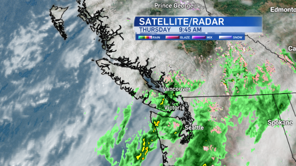
The rainfall and wind warnings have ended on the island and it’s back to your average unsettled fall weather, with the exception of a risk of thunderstorms today.
Today’s forecast
Aside from showers and occasional sunny breaks, isolated thunderstorms could develop over Vancouver Island today as an upper cold front approaches. The snow level is between 1200 and 1500 metres today, so it’s possible Mount Washington will get some snow showers in the next 24 hours. In general, winds will be fairly calm today. However, near Port Hardy, it will be windy through exposed coastal sections of the north island.
Looking ahead
If you like stormy weather you’ll be pleased to know you won’t have to wait long for the next rainy, windy day! It arrives on the weekend.
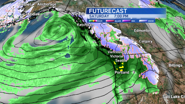
Heavy rain and gusty winds will be the weather story Saturday. By Sunday, the air mass over Vancouver island will be drier, but more convective so thunderstorms will again be a possibility.


