
What a way to start the day! This video was sent by @Steve_C19 on Twitter. I think you’ll agree, today’s sunrise near Coal Harbour overlooking Holberg Inlet was stunning, with its colourful sky and fog blanketing the valley.
Tough work environment today @CTVNewsAstrid pic.twitter.com/145gChSCyZ
— steve������ (@Steve_C19) September 28, 2017
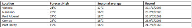
Bask in the warm sun today, because everything changes tomorrow. The throwback to summer is thanks to a late season ridge of high pressure. Today’s high temperatures are well above seasonal average, but believe it or not, nowhere near record warm.
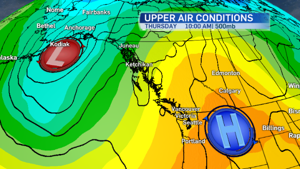
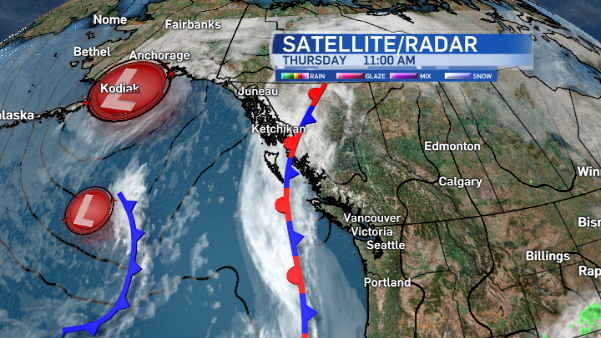
Tomorrow the ridge drifts eastward and will be replaced by an upper trough which will send a front sweeping across Vancouver Island. It brings some rain, delivers cooler temperatures, and at times it will be windy.
The trough remains in place for a couple of weeks. Long range forecast models suggest cooler temperatures on the island through Thanksgiving and into mid-October. We’ll get some showers or light rain at times, too.
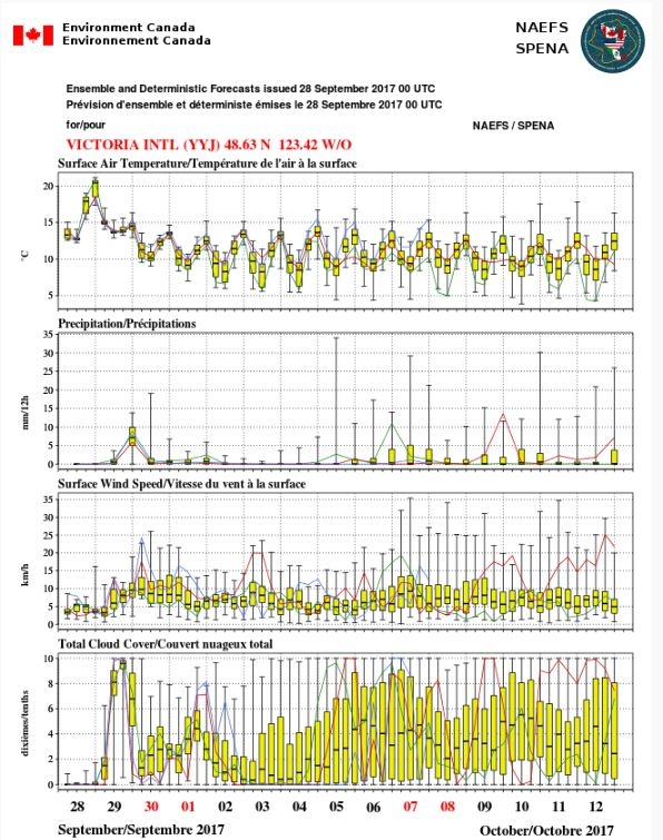
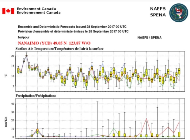
* North America Ensemble Forecast System combines Canadian and US long range forecasts. Whiskers indicate forecast range, yellow boxes show 50 per cent of the forecasts.
Moral of the story: enjoy today. It looks like this is the last hot day of the year before sweater weather settles in for good.


